Haringey
Borough van Londen  | |||
|---|---|---|---|
 | |||
 | |||
| Situering | |||
| Land | Engeland | ||
| County | Outer London | ||
| Regio | London | ||
| Coördinaten | 51°36'0"NB, 0°6'43"WL | ||
| Algemeen | |||
| Oppervlakte | 29,5983[1] km² | ||
| Inwoners (2018[2]) | 270624 (9143 inw./km²) | ||
| ONS-code | E09000014 | ||
| |||

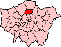
Haringey (London Borough of Haringey) is een Engels district of borough in de regio Groot-Londen, gelegen in het noorden van de metropool. De borough telt 271.224 inwoners. De oppervlakte bedraagt 30 km².
Van de bevolking is 9,8% ouder dan 65 jaar. De werkloosheid bedraagt 5,8% van de beroepsbevolking (cijfers volkstelling 2001).
Wijken in Haringey
- Crouch End
- Hornsey
- Muswell Hill
- Seven Sisters
- Tottenham
- Turnpike Lane
- Wood Green
Bronnen, noten en/of referenties
|


