Overstrand
| Overstrand | |
|---|---|
 | |
| Dados Gerais | |
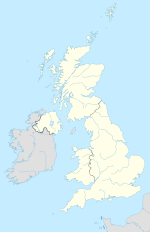
| Nação | Inglaterra |
| Região | North Norfolk |
| Condado | Norfolk |
| Área | 1.86 km² |
| População (2011) | 952 habitantes |
| Localização | |
  Overstrand | |
| 52.91798° 0' 0" N -1.34488° 0' 0" O | |
| Paróquias civis de Overstrand, código postal NR26, distrito eleitoral de North Norfolk, referência no mapa do "Ordnance Survey": TG2441 | |
Cidade do Reino Unido  | |
Overstrand é uma vila e freguesia no distrito de North Norfolk em Norfolk, Inglaterra, cerca de 22,9 milhas (36,9 km) de Norwich[1].
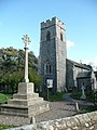
Igreja
A igreja de Roughton, denominada " Santa Martin".[2] .
História
No Domesday Book, Overstand[3] foi chamada Othestranda.[4]
Transporte
A via principal é a B1159[5], que vai de Cromer até Caister-on-Sea.
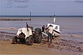
Gallery
- Overstrand
-

-

-

-
-

-


Referências
- ↑ Ordnance Survey (2002). OS Explorer Map 252 - Norfolk Coast East. ISBN 0-319-21888-0.
- ↑ Norfolk 1: Norwich and North-East, By Nikolaus Pevsner and Bill Wilson, Roughton entry. ISBN 0-300-09607-0
- ↑ The Domesday Book, Englands Heritage, Then and Now, Editor: Thomas Hinde, Norfolk, ISBN 1-85833-440-3
- ↑ The Normans in Norfolk, By Sue Margeson, Fabienne Seillier and Andrew Rogerson, Pub:1994, ISBN 0-903101-62-9
- ↑ County A to Z Atlas, Street & Road maps Norfolk, page 228 ISBN 978 1 84348 614 5
Vilas e freguesias do distrito de North Norfolk | ||
|---|---|---|
• Alby with Thwaite • Aldborough • Antingham • Ashmanhaugh • Aylmerton • Baconsthorpe • Bacton (Norfolk) • Barsham, Norfolk • Barton Turf • Beeston Regis • Binham • Blakeney • Bodham • Briningham • Brinton • Briston • Brumstead • Burgh and Tuttington • Buxton • Catfield • Cley next the Sea • Colby • Corpusty • Cromer • Dilham • Dunton • East Beckham • East Ruston • Edgefield • Erpingham • Fakenham • Felbrigg • Felmingham • Field Dalling • Fulmodeston • Gimingham • Great Snoring • Gresham • Guestwick • Gunthorpe • Hanworth • Happisburgh • Helhoughton • Hempstead • Hempton • Hickling • High Kelling • Hindolveston • Hindringham • Holkham • Holt • Honing • Horning • Horsey • Hoveton • Ingham • Ingworth • Itteringham • Kelling • Kettlestone • Knapton • Langham • Lessingham • Letheringsett with Glandford • Little Barningham • Little Snoring • Ludham • Matlaske • Melton Constable • Morston • Mundesley • Neatishead • Northrepps • North Walsham • Overstrand • Paston • Plumstead • Potter Heigham • Pudding Norton • Raynham • Roughton • Runton, West • Runton, East • Ryburgh • Salthouse • Scottow • Sculthorpe • Sea Palling • Sheringham • Sidestrand • Skeyton • Sloley • Smallburgh • Southrepps • Stalham • Stibbard • Stiffkey • Stody • Suffield • Sustead • Sutton • Swafield • Swanton Abbott • Swanton Novers • Tatterford • Tattersett • Thornage • Thorpe Market • Thurning • Thursford • Trimingham • Trunch • Tunstead • Upper Sheringham • Walcott • Walsingham • Warham • Wells-next-the-Sea • West Beckham • Westwick • Weybourne • Wickmere • Wighton • Witton • Wiveton • Wood Norton • Worstead |  | |
 | Este artigo sobre Geografia da Inglaterra é um esboço. Você pode ajudar a Wikipédia expandindo-o. |
O Commons possui uma categoria com imagens e outros ficheiros sobre Overstrand
 Portal do Reino Unido
 Portal da geografia


