Garrett County, Maryland

Garrett County, Maryland
Pengadilan Garrett County pada Desember 2013.
Flag of Garrett County, Maryland
Bendera
Seal of Garrett County, Maryland
Seal
Map of Maryland highlighting Garrett County
Lokasi di negara bagian Maryland
Map of the United States highlighting Maryland
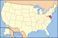
Lokasi negara bagian Maryland di Amerika Serikat
Didirikan1872
Asal namaJohn Work Garrett
SeatOakland
Kota terbesarMountain Lake Park
Wilayah
 • Keseluruhan656 sq mi (1.699 km2)
 • Daratan648 sq mi (1.678 km2)
 • Perairan8 sq mi (21 km2), 1.21%
Populasi
 • (2010)30.097
 • Kepadatan47/sq mi (18/km²)
Distrik kongres6th
Zona waktuTimur:
UTC-5 (EST) / -4 (EDT)
Situs webwww.garrettcounty.org

Koordinat: 39°17′N 79°22′W / 39.283°N 79.367°W / 39.283; -79.367 Garrett County adalah county yang terletak di Negara Bagian Maryland. Hasil pemekaran dari Allegany County pada tahun 1872. Berdasarkan Sensus 2010, jumlah penduduk di county ini mencapai 30,097 jiwa.[1] County seat dari county ini berada di Oakland.[2] Nama County ini diambil dari John Work Garrett, presiden dari Perusahaan Kereta Api Baltimore dan Ohio.[3] Wilayahnya menjadi bagian dari Maryland Barat

Referensi

  1. ^ "State & County QuickFacts". United States Census Bureau. Diarsipkan dari versi asli tanggal 2011-07-06. Diakses tanggal August 20, 2013. 
  2. ^ "Find a County". National Association of Counties. Diakses tanggal 2011-06-07. 
  3. ^ "Maryland Counties, Garrett County, Maryland". Maryland Manual On-Line. Maryland State Archives. Diarsipkan dari versi asli tanggal 2021-06-14. Diakses tanggal 2009-11-11. 
  • l
  • b
  • s
 Negara bagian Maryland
Annapolis (ibu kota)
Topik
  • Cities
  • Government
  • History
  • People
  • Congressional Delegations
  • Congressional Maps
  • Economy
  • List of Maryland-related topics
  • Visitor Attractions
Wilayah
  • Allegheny Mountains
  • Atlantic Coastal Plain
  • Baltimore‑Washington Metro Area
  • Blue Ridge
  • Chesapeake
  • Cumberland Valley
  • Delaware Valley
  • Delmarva Peninsula
  • Eastern Shore
  • Piedmont
  • Ridge and Valley
  • Southern Maryland
  • Western Maryland
  • Western Shore
Kota besar
Kota sensus
  • Adelphi
  • Arbutus
  • Arnold
  • Aspen Hill
  • Ballenger Creek
  • Bel Air North
  • Bel Air South
  • Bethesda
  • Brooklyn Park
  • Calverton
  • Camp Springs
  • Carney
  • Catonsville
  • Chesapeake Ranch Estates-Drum Point
  • Chillum
  • Clinton
  • Cockeysville-Hunt Valley
  • Colesville
  • Columbia
  • Coral Hills
  • Crofton
  • Damascus
  • Dundalk
  • East Riverdale
  • Edgewood
  • Eldersburg
  • Elkridge
  • Ellicott City
  • Essex
  • Fairland
  • Ferndale
  • Forestville
  • Fort Washington
  • Friendly
  • Germantown
  • Glen Burnie
  • Glenn Dale
  • Greater Landover
  • Greater Upper Marlboro
  • Green Haven
  • Green Valley
  • Halfway
  • Hillcrest Heights
  • Joppatowne
  • Kettering
  • Lake Shore
  • Langley Park
  • Lanham-Seabrook
  • Lansdowne-Baltimore Highlands
  • Lexington Park
  • Linganore-Bartonsville
  • Lochearn
  • Lutherville-Timonium
  • Mays Chapel
  • Middle River
  • Milford Mill
  • Montgomery Village
  • North Bethesda
  • North Laurel
  • North Potomac
  • Ocean Pines
  • Odenton
  • Olney
  • Overlea
  • Owings Mills
  • Oxon Hill-Glassmanor
  • Parkville
  • Parole
  • Pasadena
  • Perry Hall
  • Pikesville
  • Potomac
  • Randallstown
  • Redland
  • Reisterstown
  • Riviera Beach
  • Rosaryville
  • Rosedale
  • Rossville
  • St. Charles
  • Savage-Guilford
  • Severn
  • Severna Park
  • Silver Spring
  • South Gate
  • South Laurel
  • Suitland-Silver Hill
  • Towson
  • Waldorf
  • Walker Mill
  • Wheaton-Glenmont
  • White Oak
  • Woodlawn
County


Artikel bertopik Amerika Serikat ini adalah sebuah rintisan. Anda dapat membantu Wikipedia dengan mengembangkannya.

  • l
  • b
  • s