Münchweiler an der Rodalb
Pour les articles homonymes, voir Münchweiler.

Cet article est une ébauche concernant une localité allemande.
Vous pouvez partager vos connaissances en l’améliorant (comment ?) selon les recommandations des projets correspondants.
| Münchweiler an der Rodalb | |||
 | |||
 Armoiries | |||
| Administration | |||
|---|---|---|---|
| Pays |  Allemagne Allemagne | ||
| Land |  Rhénanie-Palatinat Rhénanie-Palatinat | ||
| Arrondissement (Landkreis) | Palatinat-Sud-Ouest | ||
| Bourgmestre (Ortsbürgermeister) | Timo Bäuerle | ||
| Partis au pouvoir | CDU | ||
| Code postal | 66981 | ||
| Code communal (Gemeindeschlüssel) | 07 2 35 032 | ||
| Indicatif téléphonique | 06395 | ||
| Immatriculation | PS | ||
| Démographie | |||
| Population | 2 938 hab. (2009) | ||
| Densité | 108 hab./km2 | ||
| Géographie | |||
| Coordonnées | 49° 13′ 04″ nord, 7° 42′ 15″ est | ||
| Altitude | 296 m | ||
| Superficie | 2 719 ha = 27,19 km2 | ||
| Localisation | |||
| Géolocalisation sur la carte : Allemagne
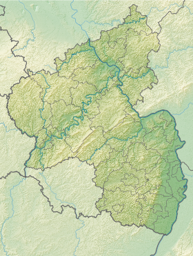
Géolocalisation sur la carte : Rhénanie-Palatinat
| |||
| Liens | |||
| Site web | www.muenchweiler.de | ||
modifier  | |||


Münchweiler an der Rodalb est une municipalité de la Verbandsgemeinde Rodalben, dans l'arrondissement du Palatinat-Sud-Ouest, en Rhénanie-Palatinat, dans l'ouest de l'Allemagne.
Références
- (de) Site web officiel de la commune de Münchweiler an der Rodalb
- (en) Cet article est partiellement ou en totalité issu de l’article de Wikipédia en anglais intitulé « Münchweiler an der Rodalb » (voir la liste des auteurs).

 Portail de la Rhénanie-Palatinat


