Vierlingsbeek
Village in North Brabant, Netherlands

Flag
51°35′46″N 6°0′37″E / 51.59611°N 6.01028°E / 51.59611; 6.01028
(2021)[1]
5821[1]
Vierlingsbeek (Dutch pronunciation: [ˌviːrlɪŋzˈbeːk]) is a village in the former municipality of Boxmeer in North Brabant province of the Netherlands. Until it was included in Boxmeer in 1998, it was a municipality of its own.[3] Since 2022 it has been part of the new municipality of Land van Cuijk.
The UN/LOCODE is NLVIE.
History
Vierlingsbeek developed in the Early Middle Ages on the river bank of the Maas. In 1756, the village was damaged by a large fire, and it developed along the Venraij to Boxmeer road.[4]
The Dutch Reformed church was built in 1843 after its predecessor from 1804 had partially collapsed in 1839. The clergy house is the former hunting cabin of William I of the Netherlands.[4] The church was decommissioned in 1997, and is used for weddings, concerts and cultural activities.[5] The Catholic St. Laurentius Church was built between 1952 and 1953 after its 1804 predecessor had been destroyed in 1944.[4]
Vierlingsbeek was home to 806 people in 1840.[5] In 1883, a railway station opened on Nijmegen to Venlo railway line. The original building was destroyed in 1945.[6] The village was heavily damaged in 1944.[4]
Vierlingsbeek was an independent municipality until 1998 when it was merged into Boxmeer. In 2022, it became part of the Land van Cuijk.[5]
Gallery
-
 Church: Sint-Laurentiuskerk
 -
 Villa in Vierlingsbeek
 -
 Railway station
 -
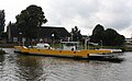 Ferry
Ferry


References
- ^ a b c "Kerncijfers wijken en buurten 2021". Central Bureau of Statistics. Retrieved 17 April 2022.
two entries
- ^ "Postcodetool for 5821AA". Actueel Hoogtebestand Nederland (in Dutch). Het Waterschapshuis. Retrieved 17 April 2022.
- ^ Ad van der Meer and Onno Boonstra, Repertorium van Nederlandse gemeenten, KNAW, 2011.
- ^ a b c d Chris Kolman & Ronald Stenvert (1997). Vierlingsbeek (in Dutch). Zwolle: Waanders. ISBN 90 400 9945 6. Retrieved 17 April 2022.
- ^ a b c "Vierlingsbeek". Plaatsengids (in Dutch). Retrieved 17 April 2022.
- ^ "station Vierlingsbeek". Stationsweb (in Dutch). Retrieved 17 April 2022.
- v
- t
- e
Populated places in the municipality of Land van Cuijk
- Beert
- Beugen
- Escharen
- Gassel
- Groeningen
- Haps
- Holthees
- Katwijk [nl]
- Landhorst [nl]
- Langenboom
- Ledeacker [nl]
- Linden
- Maashees [nl]
- Mill
- Oeffelt
- Oploo
- Overloon
- Rijkevoort
- Sambeek
- Sint Agatha [nl]
- Sint Anthonis
- Sint Hubert
- Stevensbeek [nl]
- Velp
- Vianen [nl]
- Vierlingsbeek
- Vortum-Mullem [nl]
- Wanroij
- Westerbeek [nl]
- Wilbertoord [nl]
Authority control databases | |
|---|---|
| International |
|
| National |
|


