Vahan, Armenia
Place in Gegharkunik, Armenia
Vahan Վահան | |
|---|---|
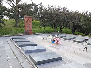
 WWII monument in Vahan | |
40°34′32″N 45°23′56″E / 40.57556°N 45.39889°E / 40.57556; 45.39889 | |
| Country |  Armenia Armenia |
| Province | Gegharkunik |
| Municipality | Chambarak |
| Founded | 1925 |
| Elevation | 1,926 m (6,319 ft) |
| Population (2011)[1] | |
| • Total | 1,127 |
| Time zone | UTC+4 (AMT) |
| Postal code | 1318 |
| Vahan, Armenia at GEOnet Names Server | |
Vahan (Armenian: Վահան) is a village in the Chambarak Municipality of the Gegharkunik Province of Armenia. Nearby upon a hill towards the eastern end of the village is an early Iron Age cyclopean fort.[2]
Etymology
When the village was founded in 1925, it was named Ordzhonikidze in honor of Soviet politician and politburo member, Sergo Ordzhonikidze.
Gallery
- World War II monument in Vahan
-

-
-


References
- ^ Statistical Committee of Armenia. "The results of the 2011 Population Census of Armenia" (PDF).
- ^ Kiesling, Brady; Kojian, Raffi (2005). Rediscovering Armenia: Guide (2nd ed.). Yerevan: Matit Graphic Design Studio. p. 83. ISBN 99941-0-121-8.
External links
- Report of the results of the 2001 Armenian Census, Statistical Committee of Armenia
- Kiesling, Brady (June 2000). Rediscovering Armenia: An Archaeological/Touristic Gazetteer and Map Set for the Historical Monuments of Armenia (PDF). Archived (PDF) from the original on 6 November 2021.
- v
- t
- e
Gegharkunik ProvinceCapital: Gavar

- Akhpradzor
- Akunk
- Areguni
- Arpunk
- Avazan
- Ayrk
- Azat
- Daranak
- Geghakar
- Geghamabak
- Geghamasar
- Jaghatsadzor
- Kakhakn
- Karchaghbyur
- Khachaghbyur
- Kut
- Kutakan
- Lchavan
- Lusakunk
- Makenis
- Mets Masrik
- Nerkin Shorzha
- Norabak
- Norakert
- Pambak
- Pokr Masrik
- Shatjrek
- Shatvan
- Sotk
- Torfavan
- Tretuk
- Tsovak
- Vanevan
- Verin Shorzha
- Zariver
Portal:
 Geography

 | This article about a location in Gegharkunik Province, Armenia is a stub. You can help Wikipedia by expanding it. |
- v
- t
- e


