Unaka, North Carolina
Unincorporated community in North Carolina, United States
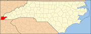
35°11′43″N 84°08′30″W / 35.19528°N 84.14167°W / 35.19528; -84.14167Unaka is an unincorporated community in Cherokee County, North Carolina, United States. Unaka is located in the Nantahala National Forest, 9.6 miles (15.4 km) northwest of Murphy. Unaka had a post office until it closed on February 15, 1986.[2][3] Unaka is a name derived from a Cherokee word meaning "white", which referred to the appearance of low-lying clouds and fog over the Unicoi Mountains.[4]
References
- ^ "Unaka". Geographic Names Information System. United States Geological Survey, United States Department of the Interior.
- ^ United States Postal Service (2012). "USPS - Look Up a ZIP Code". Retrieved February 15, 2012.
- ^ "Postmaster Finder - Post Offices by ZIP Code". United States Postal Service. Retrieved March 16, 2013.
- ^ "Community Backstory". Cherokee County Chamber of Commerce. Archived from the original on July 3, 2019. Retrieved July 3, 2019.
- v
- t
- e
Municipalities and communities of Cherokee County, North Carolina, United States
County seat: Murphy
communities
‡This populated place also has portions in an adjacent county or counties
- North Carolina portal
- United States portal
This article about a location in Cherokee County, North Carolina is a stub. You can help Wikipedia by expanding it. |
- v
- t
- e


