Tarheel, North Carolina
Unincorporated community in North Carolina, United States
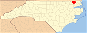
36°27′24″N 76°51′23″W / 36.45667°N 76.85639°W / 36.45667; -76.85639Tarheel is an unincorporated community in western Gates County, North Carolina. It is on the junction of U.S. Route 13, and U.S. Route 158, at an elevation of 39 feet (12 m).[1]
References
- ^ U.S. Geological Survey Geographic Names Information System: Tarheel, North Carolina
- v
- t
- e
Municipalities and communities of Gates County, North Carolina, United States
County seat: Gatesville
- Gatesville
communities
- North Carolina portal
- United States portal
This article about a location in Gates County, North Carolina is a stub. You can help Wikipedia by expanding it. |
- v
- t
- e


