Powell Marsh Wildlife Area

Protected area in northern Wisconsin, US

46°4′17″N 89°52′50″W / 46.07139°N 89.88056°W / 46.07139; -89.88056[2]Area4,850 acres (19.6 km2)Elevation1,604 ft (489 m)[2]Established1955Governing bodyWisconsin Department of Natural Resources

The Powell Marsh Wildlife Area is a 4,850-acre (19.6 km2) tract of protected land located in Vilas and Iron counties, Wisconsin, owned and partially managed by the Wisconsin Department of Natural Resources (WDNR).[3] The nearby Dead Pike Lake has drawn attention to the wildlife area from conservators and homeowners nearby due to surface and groundwater flows shared between the two, with man-made structures in the latter harming the water quality of the lake.[4]: 5 

History

Farmsteads and a short railway track used to transport lumber were the first recorded instances of development within the current bounds of the wildlife area, which were present by the 1930s. The site was naturally prone to wildfires, which were responsible for helping new vegetation spring up from the peat, which in turn attracted geese to the area. Some fires were caused by railroad activity. These wildfires have not occurred since the 1940s, and modern management uses controlled fires. The potential for continued geese hunting led hunters and landowners to petition the Wisconsin Conservation Department (a precursor to the WDNR) to establish a protected habitat area to keep stocks of geese strong.[5]: 32  In 1955, the Commissioner of Lands granted ownership of 3,125 acres within Manitowish Waters township land to the state of Wisconsin.[4]: 18 

Early efforts to secure the integrity of the habitat resulted in the construction of various dikes and drainage ditches to allow for controlled burns to take place, which would create a more hospitable environment for geese.[6][7] In 1957 a decoy flock of geese was placed in the wildlife area that was initially successful in attracting migrating flocks, yet with each passing year, the efficacy waned, until the decoy flock was removed in 1974. An investigation determined by the WDNR concluded that the dwindling flocks of geese could be attributed to a shift in migration patterns and the base inhospitableness of the marsh. The site benefits other fowl, as well as deer.[5]: 32 

In 2013 planning for the master plan resumed after a 13-year hiatus due to the WDNR focusing its efforts on the master plan for the neighboring Northern Highland-American Legion State Forest. The current master plan for the wildlife area was approved and published in December 2016.[8] The current management strategy centers on the manipulation of water levels to shift land cover to be more suitable for shorebirds and other waterfowl.[5]: 6 

Much of the original and current funding comes from the Pittman–Robertson Federal Aid in Wildlife Restoration Act.[5]: 34 [9]

Powell Marsh

The whole of the Powell Marsh Wildlife Area is classified further as a habitat management area, with the goal of providing a habitat for species that require wetland or aquatic areas. Within the confines of the Marsh, there are five separate lakes and seven flowages that are managed by the WDNR. The wildlife area is bordered by the Northern Highland-American Legion State Forest and Manitowish Chain O Lakes to the north, east, and west and the Lac du Flambeau Reservation to the south.[5]: 1 

In addition to the 4,850 acres owned by the state, there are 390 acres (1.6 km2) owned privately. There are five different types of cover in the wildlife area, including forested wetland, grassy upland islands, open water, upland forest fringe, and the most common, unforested wetland.[10]

Cover type acreage[5]: 12 
Cover type Acres Percentage cover
Forested wetland 1,284 28%
Grassy upland islands 62 1%
Open water 210 5%
Unforested wetlands 2,415 53%
Upland forest fringe 580 13%
Total acreage 4,551 (+390) 100%

Ceded territory

Flag of the Lac du Flambeau Band of Lake Superior Chippewa

The Powell Marsh Wildlife Area is within the boundaries of the ceded territory of the 1837 and 1842 treaties with the Chippewa.[11][12][13][14] These two treaties dictated that the Ojibwe tribes in the area would cede lands in the north of Wisconsin to the United States Government. In return for ceding ownership of their native lands, they were granted access to hunt, fish, and gather within some public areas. The Powell Marsh Wildlife Area is one such area, used for hunting, fishing, and other tribal activities. It is subject to management by the Lac du Flambeau Band of Lake Superior Chippewa via an Integrated Resource Management Plan.[5]: 5 

Dead Pike Lake

Dead Pike Lake is to the northwest and downstream of the Powell Marsh Wildlife Area, and the health and water quality of the lake are closely tied to man-made manipulations of the wildlife area. In the mid-1950s, the construction of water control structures and an extensive ditch and levee road system began in the wildlife area, which did restore much of the original marshland but also cut deep into the bog's semi-aquitard layer. This caused the groundwater and surface water, which feeds into Dead Pike Lake from Powell Marsh, to interact with each other.[4]: 18 [15] In addition to the iron-rich surface water that began to put increased pressure on groundwater in the area, the water control structures were built with material including taconite ore, which likely leaked more iron manganese into the water.[4]: 34 

The groundwater in the area is rich in iron, which naturally precipitates when exposed to oxygen, providing nutrients to iron-oxidizing bacteria. When water flow is prevented, naturally in low flow period and artificially through water control systems, most incoming water is from the groudwater table, and excretions from the iron bacteria accumulate, creating visible plumes of iron floc.[16]: 15, 23  The iron floc in the lake has been shown to correlate with flow rates of groundwater in the 13-mile (21 km) long levee system.[16]: 4  Not only is the iron floc visible in the lake, but it has turned the lake rusty-brown in some areas, and in others has turned the water slimy.[17][18][19]

Flora and fauna

The Powell Marsh Wildlife Area has five defined types of ground cover, and thus has multiple different species of trees. The most commonly observed trees in the wildlife area consist of aspen, white birch, red maple, red oak, white pine, black spruce, and tamarack. In addition to trees, there are various aquatic plants and shrubs, including willow and sphagnum moss.[5]: 46 

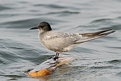
In 2016, 205 different species of bird were observed in the wildlife area, including 34 species of birds that are labeled as either protected, threatened, endangered, or of special concern. The only species of bird labeled as endangered known to either nest or migrate in the wildlife area is the black tern, which while labeled as of least concern by the IUCN, is currently on the list of endangered birds in the state of Wisconsin.[20][21] Other rare birds considered in danger found to be in the wildlife area include the LeConte's sparrow, Nelson's sparrow, and the threatened Yellow rail.[22]

Other documented rare mammalian species observed in the wildlife area include the gray wolf (listed as of special concern), hoary bat (listed as of special concern), little brown bat (threatened), and the silver-haired bat (special concern). Rare species besides mammals include the American bullfrog, mink frog, wingless mountain grasshopper, bog copper butterfly, and the frigga fritillary butterfly.[23]

The wildlife area is a habitat founded specifically for the preservation and hunting of ducks and other waterfowl and is also known for its stock of mink and muskrats.[5]: 33 

Recreation

Hunting, fishing, and trapping are allowed in the wildlife area, although other recreational activities such as camping and hiking are limited by poor soil quality. Viewing sites in the area are easily accessible by main roads in the general area, and the Marsh is a popular spot for birdwatchers.[24] Fishing is available in both Dead Pike Lake[25] and Sherman lake,[26] both of which are attached to the wildlife area and subject to catch limitations set by the WDNR,[27] with the focus of such limits being set around the catching of walleye,[28] also called the yellow pike or yellow pickerel, despite it not having any relation to the pickerel family.

There is one managed trail in the wildlife area, the 8.5-mile (13.7 km) Powell Marsh Ski Trail. The Ski Trail is managed by the Northern Highland-American Legion State Forest and is available for hiking in non-winter months. There are two other trails in the wildlife area that are under construction; the Regional Bike Trail and the Vista Flowage Loop.[29]

See also

References

  1. ^ Protected Area Profile for Powell Marsh Wildlife Area Archived April 13, 2023, at the Wayback Machine from the World Database on Protected Areas. Retrieved April 13, 2023.
  2. ^ a b "Powell Marsh". Geographic Names Information System. United States Geological Survey, United States Department of the Interior. Retrieved April 21, 2023.
  3. ^ WDNR Website Archived March 2, 2022, at the Wayback Machine- Retrieved March 2, 2022
  4. ^ a b c d "Dead Pike Lake Management Plan by Dead Pike Lake Association and Town of Manitowish Waters PDF" (PDF). Archived (PDF) from the original on April 17, 2023. Retrieved April 21, 2023.
  5. ^ a b c d e f g h i "WDNR Powell Marsh State Wildlife Area Master Plan PDF" (PDF). Archived (PDF) from the original on February 2, 2023. Retrieved August 24, 2022.
  6. ^ "The Journal of Wildlife Management PDF JSTOR". JSTOR 3798093. Archived from the original on March 2, 2022. Retrieved March 4, 2022.(subscription required)
  7. ^ "WDNR Prescribed Fire Website Page". Archived from the original on March 4, 2022. Retrieved March 4, 2022.
  8. ^ On Wisconsin Outdoors Website Archived November 16, 2022, at the Wayback Machine- Retrieved November 17, 2022
  9. ^ History, Art & Archives US House of Representatives Website Archived March 21, 2022, at the Wayback Machine- Retrieved March 2, 2022
  10. ^ WDNR Various Maps PDF Archived March 3, 2022, at the Wayback Machine- Retrieved August 24, 2022
  11. ^ TREATY WITH THE CHIPPEWA, 1837 PDF Archived March 4, 2022, at the Wayback Machine- Retrieved March 4, 2022
  12. ^ TREATY WITH THE CHIPPEWA, 1842 PDF Archived January 27, 2022, at the Wayback Machine- Retrieved March 4, 2022
  13. ^ Milwaukee Public Museum Website Archived March 4, 2022, at the Wayback Machine- Retrieved March 4, 2022
  14. ^ WDNR Ceded Territory Page Archived March 2, 2022, at the Wayback Machine- Retrieved March 2, 2022
  15. ^ WDNR Impaired Waters Detail Webpage Archived March 20, 2022, at the Wayback Machine- Retrieved March 20, 2022
  16. ^ a b "Jim Kreitlow, WDNR Water Program. 2007, WDNR PDF" (PDF). Archived (PDF) from the original on March 6, 2022. Retrieved March 6, 2022.
  17. ^ WXPR Radio "This American Life", first broadcast 2021-09-23 Archived March 6, 2022, at the Wayback Machine- Retrieved March 6, 2022
  18. ^ WDNR Water Detail of Dead Pike Lake Webpage Archived March 20, 2022, at the Wayback Machine- Retrieved March 20, 2022
  19. ^ Hydrologic investigation of Powell Marsh and its relation to Dead Pike Lake, Vilas County, Wisconsin USGS PDF Archived February 2, 2023, at the Wayback Machine- Retrieved November 17, 2022
  20. ^ WDNR Wisconsin Wildlife Action Plan c. 2015 Archived March 2, 2022, at the Wayback Machine- Retrieved March 2, 2022
  21. ^ WDNR Wisconsin Endangered and Threatened Species Laws & List Archived March 20, 2022, at the Wayback Machine- Retrieved March 20, 2022
  22. ^ eBird Website Archived March 2, 2022, at the Wayback Machine- Retrieved March 2, 2022
  23. ^ WDNR Master Plan PDF Archived February 2, 2023, at the Wayback Machine- Retrieved August 24, 2022
  24. ^ Vilas County Website on Powell Marsh Loop Archived May 17, 2022, at the Wayback Machine- Retrieved March 20, 2022
  25. ^ WDNR Webpage on Dead Pike Lake Archived March 6, 2022, at the Wayback Machine- Retrieved March 6, 2022
  26. ^ WDNR Webpage on Sherman Lake Archived March 6, 2022, at the Wayback Machine- Retrieved March 6, 2022
  27. ^ WDNR Webpage on Fishing Regulations Archived March 6, 2022, at the Wayback Machine- Retrieved March 6, 2022
  28. ^ WDNR PDF from 1998 on Wisconsin's Walleye Management Plan Archived March 2, 2022, at the Wayback Machine- Retrieved March 6, 2022
  29. ^ Vilas County Website on Outdoor Recreation at the Powell Marsh Wildlife Area Archived March 6, 2022, at the Wayback Machine- Retrieved March 6, 2022

External links

  • U.S. Geological Survey Map at the U.S. Geological Survey Map Website. Retrieved March 2, 2022.
  • The Economic Impact of the 1837 and 1842 Chippewa Treaties at JSTOR. Retrieved March 2, 2022. (subscription required)
  • v
  • t
  • e
Federal
National Park Service
National Forests
National Wildlife Refuges
National Trails
National Estuarine Research Reserves
National Marine Sanctuaries
National Wild and Scenic Rivers
  • St. Croix River
  • Wolf River
National Wilderness Preservation System
State
State Parks
State Natural Areas
  • Ableman's Gorge
  • Abraham's Woods
  • Adiantum Woods
  • Albany Sand Prairie & Oak Savanna
  • Allen Creek Wetlands
  • Allequash Lake
  • Alvin Creek Headwaters
  • Ancient Aztalan Village
  • Anvil Lake Trail
  • Apostle Islands Critical Species
  • Apostle Islands Maritime Cliffs
  • Apostle Islands Maritime Forest
  • Apostle Islands Sandscape
  • Apostle Islands Yew Forest
  • Apple River Canyon
  • Arbutus Oaks
  • Arena Pines and Sand Barrens
  • Argonne Experimental Forest
  • Atkins Lake & Hiles Swamp
  • Audubon Goose Pond
  • Aurora Lake
  • Avoca River-Bottom Prairie
  • Avon Bottoms
  • Badfish Creek Wet Prairie & Spring Seeps
  • Baileys Harbor Boreal Forest and Wetlands
  • Bakken's Pond
  • Baraboo River Floodplain Forest
  • Bark Bay Slough
  • Barksdale Ponds
  • Barneveld Prairie
  • Barney Creek
  • Bass Hollow
  • Bass Lake Fen
  • Bass Lake Peatlands
  • Bass Lake Preserve
  • Bastile Lake
  • Battle Bluff Prairie
  • Battle Creek Hemlocks
  • Bauer-Brockway Barrens
  • Baxter's Hollow
  • Bay City Mine
  • Bayshore Blufflands
  • Bean Lake
  • Bear Beach
  • Bear Bluff
  • Bear Caves
  • Bear Creek Cave
  • Bear Creek Hemlocks
  • Bear Creek Sedge Meadow
  • Bear Lake Sedge Meadow
  • Bear Lake Slough
  • Bearsdale Creek & Hyatt Springs
  • Beaver Brook
  • Beaver Creek
  • Belden Swamp
  • Belmont Mound
  • Belmont Prairie
  • Berg Prairie and Billy Goat Ridge
  • Bergen Bluffs
  • Berlin Fen
  • Beulah Bog
  • Bibon Swamp
  • Big and Little Marsh
  • Big Bay Sand Spit and Bog
  • Big Beaver Meadow
  • Big Eau Pleine Woods
  • Big Island
  • Big Manitou Falls
  • Big Rock Pines
  • Big Swamp
  • Big Swamp Tamarack Fen
  • Bittersweet Lakes
  • Black Creek Bog
  • Black Earth Rettenmund Prairie
  • Black Lake Bog
  • Black River Savanna
  • Black Tern Bog
  • Blackhawk Island
  • Blackjack Springs
  • Bloch Oxbow
  • Blomberg Lake
  • Blue Hills Felsenmeer
  • Blue River Bluffs
  • Blue River Sand Barrens
  • Blue Swamp
  • Blueberry Swamp
  • Blueberry Trail
  • Bluff Creek
  • Bogus Swamp
  • Bohn Lake
  • Bonita Country
  • Borah Creek Prairie
  • Border Lakes
  • Borst Valley Sedge Meadow
  • Boscobel Bluffs
  • Bradley Creek Swamp Conifers
  • Brady's Bluff Prairie
  • Brant Brook Pines
  • Brockway Ponds
  • Brooks Bluff
  • Browntown Oak Forest
  • Brule Glacial Spillway
  • Brule River Boreal Forest
  • Brule River Cliffs
  • Brule Rush Lake
  • Brunsweiler River and Mineral Lake
  • Brush Creek Hemlocks
  • Buckhorn Barrens
  • Buena Vista Prairie Chicken Meadow
  • Buena Vista Quarry Prairie
  • Buffalo River Trail Prairies
  • Butler Lake and Flynn's Spring
  • Cady's Marsh
  • Camp Five Lake
  • Camp Lake and Pines
  • Camp Nine Pines
  • Camp Three Lake
  • Canoe Landing Prairie
  • Caroline Lake
  • Carver-Roehl Woods
  • Caryville Savanna
  • Cassville Bluffs
  • Castle Mound Pine Forest
  • Catfish Eddy Terraces
  • Cathedral Pines
  • Catherine Lake Hemlock-Hardwoods
  • Cave Point-Clay Banks
  • Cedar Grove Hawk Research Station
  • Cedarburg Beech Woods
  • Cedarburg Bog
  • Centennial Bedrock Glade
  • Charles Pond
  • Chequamegon Hardwoods
  • Cherney Maribel Caves
  • Cherokee Marsh
  • Cherry Lake Sedge Meadow
  • Chimney Rock Oak Opening
  • Chippewa Moraine Lakes
  • Chippewa Trail
  • Chiwaukee Prairie
  • Chub and Mud Lake Riverine Marsh
  • Chub Lake Oak Savanna
  • Clifford Messinger Dry Prairie & Savanna Preserve
  • Clover Valley Fen
  • Coffee Swamp
  • Comstock Bog-Meadow
  • Coon Creek Cliffs
  • Coon Fork Barrens
  • Copper Falls
  • County Line Barrens and Forest
  • Cranberry Creek Mound Group
  • Crandon Ribbed Fen
  • Crex Sand Prairie
  • Crooked Lake Wetlands
  • Cudahy Woods
  • Cylon
  • Dalles of the St. Croix River
  • Day Lake
  • Deansville Fen
  • Deer Creek Tamarack Bog
  • Deer Fly Swamp
  • Deer Island
  • Deer Mountain
  • Dells of the Eau Claire River
  • Dells of the Wisconsin River
  • Detroit Harbor
  • Devil's Backbone
  • Devil's Lake Oak Forest
  • Devine Lake & Mishonagon Creek
  • Dewey Heights Prairie
  • Dewey Marsh
  • Diamond Lake
  • Diamond Roof
  • Doering Woods
  • Dorothy Lake
  • Dory's Bog and Hunt Hill
  • Drummond Woods
  • Dry Lake
  • Dunbar Barrens
  • Dunn Lake
  • Dunnville Barrens
  • Dupage Lake Peatlands
  • Durst Rockshelter
  • Dwight's Point and Pokegama Wetlands
  • Eagle Centre Prairie
  • Eagle Eye
  • Eagle Oak Opening
  • East Bluff
  • East Fork Chippewa River
  • East Fork of the Black River
  • Echo Lake
  • Eighteen Mile Creek
  • Ekdall Wetlands
  • Elk River Valley
  • Ellison Bluff
  • Emmons Creek Barrens
  • Empire Prairies
  • Empire Swamp
  • English Lake Hemlocks
  • Enterprise Hemlocks
  • Ericson Creek Forest and Wetlands
  • Eureka Maple Woods
  • Europe Bay Woods
  • Fair Meadows
  • Fairy Chasm
  • Fairyland
  • Farmington Bottoms
  • Faville Prairie
  • Fern Dell Gorge
  • Ferry Bluff
  • Finnerud Pine Forest
  • Fish Lake Meadow
  • Fish Lake Pines
  • Five Mile Barrens
  • Five-Mile Bluff Prairie
  • Flambeau River Hardwood Forest
  • Flambeau Wetlands
  • Flat Lake
  • Flora Spring Pond
  • Flume Creek Cedars
  • Forbes Springs
  • Fort McCoy
  • Foulds Creek
  • Fountain Creek Wet Prairie
  • Fourmile Island Rookery
  • Fox Maple Woods
  • Franklin and Butternut Lakes
  • Franklin Savanna
  • French Creek Fen
  • French Creek North
  • Frog Lake and Pines
  • Gasner Hollow Prairie
  • Genesse Oak Opening and Fen
  • Germain Hemlocks
  • Germania Wet Prairie
  • Ghost Lake
  • Giant White Pine Grove
  • Gibraltar Rock
  • Glenn Creek Barrens
  • Glocke Lake
  • Gobler Lake
  • Goose Lake
  • Goose Lake Drumlins
  • Gotham Jack Pine Barrens
  • Grand Island
  • Grandma Lake
  • Grassy Lake
  • Great River Trail Prairies
  • Hagar Mountain
  • Haley Creek Swamp
  • Half Moon Bottoms
  • Hanson Lake Wetlands
  • Hardscrabble Prairie
  • Haskell Noyes Memorial Woods
  • Hawkins Hemlock-Hardwood Forest
  • Hawkinson Creek Wet Prairie
  • Haymeadow Creek
  • Haymeadow Flowage
  • Headwater Lakes
  • Hedmark Pines
  • Hemlock Draw
  • High Cliff Escarpment
  • Highway K Woods
  • Hiles Wetlands
  • Hog Island Tamaracks
  • Hogback Prairie
  • Holland Red Maple Swamp
  • Holland Sand Prairie
  • Holmboe Conifer Forest
  • Honey Creek
  • Hook Lake Bog
  • Hortonville Bog
  • Houghton Falls
  • Hub City Bog
  • Huiras Lake
  • Hulburt Creek Woods
  • Hunting River Alders
  • Inch Lake
  • Interstate Lowland Forest
  • Ipswich Prairie
  • Island Lake Hemlocks
  • Jackson Creek Woods
  • Jackson Harbor Ridges
  • Jackson Marsh
  • Jay Creek Pine Forest
  • Jean Brunet Woods
  • Jefferson Tamarack Swamp
  • Johnson Falls
  • Johnson Hill Kame
  • Johnson Lake Barrens
  • Jones Lake
  • Jump River Woods
  • Jung Hemlock-Beech Forest
  • Kamrath Creek Forest and Fen
  • Kangaroo Lake
  • Karcher Springs
  • Karner Blue Meadow
  • Keller Whitcomb Creek Woods
  • Kelly Lake Hemlocks
  • Kelly Lynn Bog
  • Kentuck Lake
  • Kessler Railroad Prairie
  • Ketchum Creek Pines
  • Kettle Hole Woods
  • Kettle Moraine Low Prairie
  • Kettle Moraine Oak Opening
  • Kettle Moraine Red Oaks
  • Kewaskum Maple-Oak Woods
  • Kickapoo Valley Reserve
  • Kickapoo Wild Woods
  • Kidrick Swamp
  • Kieper Creek
  • Kingston Pines
  • Kinnickinnic River Gorge and Delta
  • Kinnickinnic Wet Prairie
  • Kirby Lake Hardwoods
  • Kissick Alkaline Bog Lake
  • Kohler Park Dunes
  • Kohler-Peet Barrens
  • Koro Prairie
  • Koshkonong Corners
  • Kroenke Lake
  • Krueger Pines
  • Kurtz Woods
  • La Crosse River Trail Prairie
  • LaFave Swamp
  • Lake Alva Birch-Hemlock
  • Lake Evelyn
  • Lake Helane
  • Lake Lackawanna
  • Lake Laura Hardwoods
  • Lake Noquebay Sedge Meadow
  • Lake of the Pines Conifer-Hardwoods
  • Lake Owen Hardwoods
  • Lake Two Pines
  • Lampson Moraine Pines
  • LaSage Bottoms
  • Lauterman Lake
  • Lawin Sedge Meadow
  • Lawrence Creek
  • Lawrence Lake
  • Lawrence Prairie
  • Lawrence Lake
  • Lemonweir Bottomland Hardwood Forest
  • Lily Lake
  • Lima Bog
  • Limery Ridge Savanna
  • Little Bear Hemlocks
  • Little Lake
  • Little Willow Drumlin
  • Little Wolf River
  • Lodde's Mill Bluff
  • Lodi Marsh
  • Logan Creek
  • Loon Lake Woods
  • Lost Canoe
  • Lost Creek Bog
  • Lost Lake
  • Lost Lake Esker
  • Lower Chippewa River
  • Lower Narrows
  • Lower Tomahawk River Pines
  • LTC Old Growth Forest
  • Lulu Lake
  • Lunch Creek Wetlands
  • Magnolia Bluff
  • Maiden Rock Bluff
  • Marinette County Beech Forest
  • Marsh Miller Cedars
  • Marshall's Point
  • Martin's Woods
  • Mary Lake
  • Mayville Ledge Beech-Maple Woods
  • Mazomanie Bottoms
  • Mazomanie Oak Barrens
  • McCarthy Lake and Cedars
  • McCaslin Mountain
  • McGilvra Woods
  • Mead Conifer Bogs
  • Meadow Valley Barrens
  • Mecan River Pine-Oak Forest
  • Mecan Springs
  • Memorial Grove Hemlocks
  • Meridian Park
  • Midway Railroad Prairie
  • Mill Bluff
  • Millston Sand Barrens
  • Millville Oak Woodlands
  • Milwaukee River and Swamp
  • Milwaukee River Floodplain Forest
  • Milwaukee River Tamarack Lowlands and Dundee Kame
  • Minito Lake
  • Mink River
  • Mirror Lake Pine Oak Forest
  • Miscauno Cedar Swamp
  • Mondeaux Hardwoods
  • Moonlight Bay Bedrock Beach
  • Moose Lake
  • Moose River Cedar Hills
  • Moquah Barrens
  • Morgan Coulee Prairie
  • Motts Ravine
  • Mount Pisgah Hemlock-Hardwoods
  • Mountain Lake
  • Mud Lake
  • Mud Lake - Radley Creek Savanna
  • Mud Lake Bog
  • Mud Lake Fen and Wet Prairie
  • Mud Lake Forest and Ponds
  • Muddy Creek Sedge Meadow
  • Muehl Springs
  • Muir Park
  • Mukwa Bottomland Forest
  • Mukwonago River
  • Mullet Creek White Cedar Wetland
  • Muralt Bluff Prairie
  • Muskego Park Hardwoods
  • Myklebust Lake
  • Namekagon Barrens
  • Namekagon Fen
  • Natural Bridge and Rockshelter
  • Navarino Cedar Swamp
  • Navarino Sedge Meadow
  • Necedah Oak-Pine Forest
  • Necedah Oak-Pine Savanna
  • Neda Mine
  • Nell Lake
  • Nelligan Lake
  • Nelson-Trevino Bottoms
  • Nemadji River Floodplain Forest
  • New Auburn Sedge Meadow
  • New Hope Pines
  • New Munster Bog Island
  • New Observatory Woods
  • Newark Road Prairie
  • Newport Conifer-Hardwoods
  • Nichols Creek Cedars and Springs
  • Nichols Creek East Cedars
  • Nine Mile Island
  • Nipissing Swamp
  • Nixon Lake
  • No Name Lake
  • North Bay
  • North Bend Wet Prairie
  • North Branch Bottoms
  • North Country Trail Hardwoods
  • North Fork Eau Claire River
  • North Fork Pines
  • North of North Shattuck Lake
  • North Otter Creek
  • North Pikes Creek Boreal Forest
  • North Pikes Creek Boreal Forest
  • Northeast Lake
  • Norway Point Bottomlands
  • Nourse Sugarbush
  • Oakfield Ledge
  • Oakfield Railroad Prairie
  • Observatory Hill
  • Ohmart Wetlands
  • Oliver Prairie
  • Olson Oak Woods
  • One Stone Lake Hemlocks
  • Orion Mussel Bed
  • Osceola Bedrock Glades
  • Oshkosh-Larsen Trail Prairies
  • Ottawa Lake Fen
  • Otter Creek Oak Barrens
  • Owl Creek Fen Savanna
  • Oxbo Pines
  • Oxbow Rapids
  • Page Creek Marsh
  • Pan Hollow
  • Papoose Creek Pines
  • Parfrey's Glen
  • Parrish Oak Savanna
  • Pat Shay Lake
  • Patterson Hemlocks
  • Pea Creek Sedge Meadow
  • Peat Lake
  • Pecatonica River Woods
  • Peninsula Niagara Escarpment
  • Peninsula Park Beech Forest
  • Peninsula Park White Cedar Forest
  • Perkinstown Hemlocks
  • Peshtigo Brook Meadow & Woods
  • Peshtigo Harbor Lacustrine Forest
  • Peshtigo River Delta Marshes
  • Pewit's Nest
  • Pickerel Lake
  • Pickerel Lake Fen
  • Pine Cliff
  • Pine Hollow
  • Pine Island Savanna
  • Pirus Road Swamp
  • Plagge Woods
  • Plainfield Tunnel Channel Lakes
  • Pleasant Valley Conservancy
  • Plover River Woods
  • Plum Creek Woods
  • Plum Lake Hemlock Forest
  • Point Beach Ridges
  • Pokegama Carnegie Wetlands
  • Pope Lake
  • Popple River Corridor
  • Poppy's Rock
  • Port Wing Boreal Forest
  • Portland Maples
  • Powers Bluff Maple Woods
  • Priest Rock
  • Princeton Prairie
  • Puchyan Prairie
  • Putnam Park
  • Quincy Bluff and Wetlands
  • Rainbow Wetlands
  • Rat Lake Swamp and Popple River Headwaters
  • Red Banks Alvar
  • Red Cedar Lake
  • Red Cedar River Savanna
  • Red Oak Bottoms
  • Reed Lake Meadow
  • Renak-Polak Maple Beech Woods
  • Rhine Center Bog
  • Rib Mountain Talus Forest
  • Rice Creek
  • Rice Lake
  • Richter Lake Hemlocks
  • Richwood Bottoms
  • Ridgeway Pine Relict
  • Riley Lake
  • Riveredge Creek and Ephemeral Pond
  • Robinson Creek Pines
  • Roche-A-Cri Mound
  • Roche-A-Cri Woods
  • Rock Creek Felsenmeer
  • Rock Island Woods
  • Rock Lake
  • Rock River Prairie
  • Rocky Run Oak Savanna
  • Romance Prairie
  • Rose Lake
  • Rush Creek
  • Rush Lake
  • Rush River Delta
  • Sajdak Springs
  • Sand Creek Pines
  • Sander's Park Hardwoods
  • Sapa Spruce Bog
  • Savage Lake
  • Schluckebier Prairie
  • Schmidt Maple Woods
  • Scott Lake and Shelp Lake
  • Scuppernong Prairie
  • Seagull Bar
  • Shaky Lake
  • Shallow Lake
  • Silver Creek and Mondeaux River
  • Silver Lake Bog
  • Sister Islands
  • Skinner Creek Hardwoods
  • Skunk and Foster Lakes
  • Skunk Creek Woods
  • Smith Drumlin Prairie
  • Smith Slough and Sand Prairie
  • Snake Creek Fen
  • Snapper Prairie
  • Snoose Creek
  • Snow Bottom
  • Snow Falls Creek
  • Sohlberg Silver Lake
  • Solon Springs Sharptail Barrens
  • South Bluff/Devil's Nose
  • South Branch Beech Grove
  • South Fork Barrens
  • Spaulding Fen
  • Spider Lake
  • Spread Eagle Barrens
  • Spring Brook Drumlins
  • Spring Green Preserve
  • Spring Lake
  • Springstead Muskeg
  • Springvale Wet Prairie
  • Spruce Grouse Swamp
  • Spruce Lake Bog
  • Spur Lake
  • Squirrel River Pines
  • St. Croix Ash Swamp
  • St. Croix Islands
  • St. Croix Seeps
  • St. Peter's Dome
  • Standing Cedars
  • Starlight Wetlands
  • Sterling Barrens
  • Stockbridge Ledge Woods
  • Stone Lake Pines
  • Straight Lake Tamarack Fen
  • Sugar Camp Hemlocks
  • Sugar Creek Bluff
  • Sugar River Wetlands
  • Suk Cerney Peatlands
  • Summerton Bog
  • Sunrise Lake
  • Swamp Creek Fen
  • Swamp Lake
  • Swan Lake Sedge Meadow and Barrens
  • Swan Lake Tamaracks
  • Swan Lake Wet-mesic Prairie
  • Swenson Wet Prairie
  • Tamarack Creek Bog
  • Tar Dam Pines
  • Tealey Creek Cedars
  • Tellock's Hill Woods
  • Texas Island Woods
  • The Ridges Sanctuary
  • Thornapple Hemlocks
  • Thorp Pond
  • Thunder Mountain
  • Thunder River Swamp
  • Tichigan Springs and Fen
  • Tiffany Bottoms
  • Toft Point
  • Tomahawk Lake Hemlocks
  • Totagatic Highlands Hemlocks
  • Totogan Pines
  • Tower Hill Bottoms
  • Town Corner Cedars
  • Town Line Lake and Woods
  • Toy Lake Swamp
  • Trade River Forest and Wetlands
  • Tranus Lake
  • Trempealeau Mountain
  • Trempealeau River Meadow
  • Trenton Bluff Prairie
  • Trout Lake Conifer Swamp
  • Trout River
  • Tucker Lake Hemlocks
  • Tula Lake
  • Tunnel Channel Woods
  • Tunnelville Cliffs
  • Turtle Flambeau Peatlands
  • Twin Lakes Bog
  • Two Creeks Buried Forest
  • Two Lakes Pine-Oak Forest
  • Upper Black River
  • Upper Brunet River
  • Upper Buckatabon Springs
  • Upper Fox Headwaters
  • Upper Kaubashine Creek
  • Upper Little Wolf
  • Upper Nemadji River Floodplain Forest
  • Upper Tomahawk River Pines
  • Van Loon Floodplain Forest
  • Van Loon Floodplain Savanna
  • Van Vliet Hemlocks
  • Vosse Coulee
  • Wabikon Lake
  • Ward/Swartz Decatur Woods
  • Warnimont Bluff Fens
  • Washburn Marsh
  • Waterloo Prairie
  • Waterloo Quartzite Outcrops
  • Waubesa Wetlands
  • Waupee Lake Swamp
  • Waupun Park Maple Forest
  • Wauzeka Bottoms
  • Wedde Creek Savanna
  • Weir White Oaks
  • Wheeler Lake
  • White Cliff Fen and Forest
  • White River Boreal Forest
  • White River Breaks
  • White River Prairie Tamarack
  • White River Sedge Meadow
  • Whitefish Dunes
  • Whitman Bottoms Floodplain Forest
  • Wildcat Ridge
  • Wilson Lake
  • Winchester Meadow
  • Wind Pudding
  • Wisconsin Slough
  • Wolf River Bottoms
  • Woodland Dunes
  • Woodman Lake Sand Prairie & Dead Lake
  • Woods Creek
  • Wyalusing Hardwood Forest
  • Wyalusing Walnut Forest
  • Yellow River Floodplain Forest
  • Yellow River Ice-walled Lake Plain
  • Yellow River Oxbows
  • Yellowstone Savanna
  • York Prairie
  • Young Prairie
State Recreation Areas
State Forests
State Historical Sites
State Wildlife Areas
  • Ackley
  • Adell
  • Albany
  • Allenton
  • Amberg
  • Amsterdam Sloughs
  • Augusta
  • Avon Bottoms
  • Badfish Creek
  • Balsam Branch
  • Barker Creek
  • Bear Lake
  • Beaver Brook
  • Bierbrauer
  • Big Beaver Creek
  • Big Muskego Lake
  • Big Swamp
  • Bill Cross
  • Blackhawk Lake
  • Bloomfield
  • Borst Valley
  • Brillion
  • Brooklyn
  • Brusky
  • Buckhorn
  • Buena Vista
  • Burlington
  • C.D. Besadny
  • Casey Lake
  • Chief River
  • Chimney Rock
  • Clam Lake
  • Clay Corners
  • Clover Valley
  • Colburn
  • Collins Marsh
  • Crex Meadows
  • Cylon Marsh
  • Cylon
  • Deansville
  • Deer Creek
  • Dell Creek
  • Deppe
  • Dewey Marsh
  • Dike 17
  • Douglas County
  • Dover
  • Dunnville
  • Eau Galle River
  • Eldorado
  • Emerald Valley
  • Evansville
  • Fish Lake
  • Flat Creek
  • Footville
  • French Creek
  • Galbraith
  • Gardner Swamp
  • Germania Marsh
  • Gilbert Creek
  • Goose Lake (Burnett County)
  • Goose Lake (Dane County)
  • Goose Pond
  • Grand River Marsh
  • Grassy Lake (Barron County)
  • Grassy Lake (Columbia County)
  • Green Bay West Shores
  • Greenwood
  • Hacker Drive
  • Hay Creek
  • Hay Creek-Hoffman Lake
  • Hay River
  • Highway 144
  • Highway T
  • Holland
  • Honey Creek Streambank
  • Honey Creek
  • Hook Lake Bog-Grass Lake
  • Hoosier Creek
  • Horicon Marsh
  • Jackson Marsh
  • Jaeger's Island
  • Jefferson Marsh
  • Jennings Creek
  • Joel Marsh
  • Johnson
  • Karcher
  • Kickapoo River Bell Center
  • Kickapoo River Wauzeka Unit
  • Kiel Marsh
  • Killsnake
  • Kimberly Clark
  • Kinnickinnic River Oscar Lee
  • Kinnickinnic River Potton
  • Kinnickinnic River Headwaters
  • Kinnickinnic River South Fork
  • Kissick Swamp
  • Knapp Creek
  • Koshkonong
  • Lake Mills
  • Lake Noquebay
  • Lake Pepin
  • Lakes Coulee
  • Lambs Creek
  • Lawrence Creek
  • Leola Marsh
  • Liberty Creek
  • Lightning Creek
  • Lima Marsh
  • Little Rice
  • Lodi Marsh
  • Loon Lake
  • Lundy Pond
  • Lyons
  • Mack
  • Maine
  • Manion
  • Mashek Creek
  • McAdams
  • McKenzie Creek
  • McMillan Marsh
  • Mead
  • Meadow Valley
  • Morgan Marsh
  • Mount Hope
  • Mud Lake (Columbia County)
  • Mud Lake (Dane County)
  • Mud Lake (Dodge County)
  • Muddy Creek
  • Mukwa
  • Mullet Creek
  • Nagel
  • Namekagon Barrens
  • Navarino
  • New Auburn
  • New Munster
  • New Wood
  • Nichols Creek
  • North Bend Bottoms
  • North Branch Milwaukee River
  • Oakridge
  • Oden
  • Omer Springs
  • Otter Creek
  • Outagamie
  • Paradise Marsh
  • Paradise Valley
  • Paul J. Olson
  • Pershing
  • Peshtigo Brook
  • Peter Helland
  • Peters Marsh
  • Pierce County Islands
  • Pine Island
  • Pleasant Valley
  • Potato Creek
  • Powell Marsh
  • Poygan Marsh
  • Prince's Point
  • Quaderer's Creek
  • Rat River
  • Ray
  • Ray Morrison Memorial
  • Rice Beds Creek
  • Ridgeville
  • Rock Falls
  • Rome Pond
  • Rush River
  • Sampson
  • Sandhill
  • Schmit
  • Scuppernong River
  • Sette
  • Shaw Marsh
  • Sheboygan Marsh
  • Silvernail
  • South Beaver Creek
  • Spring Creek
  • St. Croix Islands
  • Star Prairie Seed Farm
  • Storrs Lake
  • Straight Lake
  • Swan Lake
  • Sweeny Pond
  • Swinging Gate
  • Tamarack Creek
  • Ten Mile Creek (Rusk County)
  • Ten Mile Creek (Saint Croix County)
  • Theresa Marsh
  • Thunder Lake
  • Tichigan
  • Tiffany
  • Tollefson Marsh
  • Tom Lawin
  • Totagatic Lake
  • Totogatic
  • Town Corner
  • Troy
  • Turtle Creek
  • Turtle Valley
  • Ulrich
  • Underwood
  • Van Loon
  • Vermillion River
  • Vernon
  • Vosse Coulee
  • Washington Creek
  • Waterloo
  • Waunakee Marsh
  • Weirgor Springs
  • West Taylor
  • Whalen Creek
  • White River
  • White River Marsh
  • Whitman Dam
  • Willow River
  • Wind Lake
  • Wolf River Bottoms Herb Behnke
  • Wolf River Bottoms LaSage
  • Wolf River
  • Wood County
  • Woodboro Lakes
  • Yellow River
  • Yellowstone