Pintadito
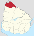
Suburb of Artigas in Artigas Department, Uruguay
30°26′2″S 56°27′34″W / 30.43389°S 56.45944°W / -30.43389; -56.45944 Uruguay
 (2011)
55000
Pintadito is a southern suburb of the capital city Artigas of Artigas Department in northern Uruguay.
Geography
It is located on Route 30, about 5 kilometres (3.1 mi) south of the city centre, after the suburb Cerro Ejido.
The stream Arroyo Pintadito, a tributary of Río Cuareim, flows east of the suburb.
Population
In 2011, Pintadito had a population of 1,642 inhabitants.[1]
| Year | Population |
|---|---|
| 1985 | 558 |
| 1996 | 1,067 |
| 2004 | 1,487 |
| 2011 | 1,642 |
Source: Instituto Nacional de Estadística de Uruguay[2]
References
External links
- INE map of Artigas, Pintadito, Cerro Ejido, Cerro Signorelli and Cerro San Eugenio
- v
- t
- e
 Artigas Department of Uruguay
Capital: Artigas
villages
- Artigas
- Baltasar Brum
- Bella Unión
- Bernabé Rivera
- Cainsa
- Cerro Ejido
- Colonia Palma
- Coronado
- Cuareim
- Franquia
- Las Piedras
- Mones Quintela
- Pintadito
- Sequeira
- Tomás Gomensoro
- Topador
 | This article about a place in Artigas Department is a stub. You can help Wikipedia by expanding it. |
- v
- t
- e


