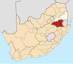
Perdekop
Place in Mpumalanga, South Africa
27°10′S 29°38′E / 27.167°S 29.633°E / -27.167; 29.633 (2011)[1]
2465
2465
Perdekop, (Afrikaans for horses hill), is a small town situated on top of a 1,889 m peak in the Mpumalanga province, in South Africa. It is a village 38 km north of Volksrust and 47 km south of Standerton.
History
Formerly Paardekop, ‘horses hill’, from the practice of keeping horses there when horse-sickness prevailed in lower lying areas.[2]
The town was established during an equine sickness epidemic when farmers found that when they brought their horses to the top of this hill they were protected from the sickness.[3]: 303 During the Second Boer War the British operated a lookout balloon here to monitor Boer activities.
References
- v
- t
- e
Municipalities and communities of Gert Sibande District Municipality, Mpumalanga
District seat: Ermelo

- Amersfoort
- Daggakraal
- Perdekop
- Volksrust
- Wakkerstroom


