Pekela
Municipality in Groningen, Netherlands

Flag

Coat of arms
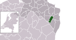
Location of Pekela (green) in the province of Groningen (dark grey) in the Netherlands (light grey)
(January 2021)[4]
9662–9669
Pekela (Dutch pronunciation: [ˈpeːkəlaː] ⓘ) is a municipality in the province of Groningen in the Netherlands. It was created in 1990 when Oude Pekela and Nieuwe Pekela were merged.
Geography

Pekela is located at 53°6′N 7°0′E / 53.100°N 7.000°E / 53.100; 7.000 in the southeast of the province of Groningen in the northeast of the Netherlands. It is bordered by the municipalities of:
- Oldambt (in the north)
- Bellingwedde (east)
- Stadskanaal (south)
- Veendam (west)
- Menterwolde (northwest).
The river Pekel Aa crosses the municipality from north to south. The main population centres in the municipality are the villages of Boven Pekela [nl] (Upper Pekela), Nieuwe Pekela (New Pekela), and Oude Pekela (Old Pekela). Part of the village of Alteveer and the hamlets of Bronsveen and Hoetmansmeer [nl] are also in the municipality.
The municipality has a total area of 50.20 km2 (19.38 sq mi), of which 49.04 km2 (18.93 sq mi) is land and 1.16 km2 (0.45 sq mi) is water.[2]
Governance
The mayor (burgemeester) of Pekela is Jaap Kuin of the Labour Party.[1] The municipal council consists of 15 seats, which are divided as follows:
| Municipality seats | |||||||||||||||
|---|---|---|---|---|---|---|---|---|---|---|---|---|---|---|---|
| Party | 2006 | 2010 | 2014 | 2018[5] | 2022[6] | ||||||||||
| SP | 3 | 3 | 4 | 4 | 3 | ||||||||||
| Samen Voor Pekela | - | 4 | 3 | 3 | 3 | ||||||||||
| PvdA | 7 | 3 | 2 | 2 | 2 | ||||||||||
| CDA | 2 | 1 | 2 | 2 | 2 | ||||||||||
| GroenLinks | 1 | 2 | 1 | 1 | 2 | ||||||||||
| PVV | - | - | - | 2 | 2 | ||||||||||
| VVD | 1 | 1 | 2 | 1 | 1 | ||||||||||
| ChristenUnie | 1 | - | 1 | - | - | ||||||||||
| VCP | - | - | 1 | - | - | ||||||||||
| Total | 15 | 15 | 15 | 15 | 15 | ||||||||||
Demographics
In 2021, the municipality had a total population of 12,176, a population density of 248/km2 (640/sq mi).[4]
Notable people
- Jan de Boer (1859 in Nieuwe Pekela – 1941) a Dutch gymnast who competed in the 1908 Summer Olympics[7]
- Fré Meis (1921–1992), communist politician[8]
- Janneke Snijder-Hazelhoff (born 1952 in Nieuwe Pekela) a Dutch farmer and politician[9]
- Gerard Wiekens (born 1973 in Oude Pekela) a Dutch former footballer with 518 club caps who played for SC Veendam and Manchester City F.C.[10]
Gallery
-
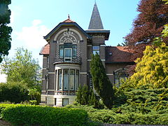 Villa Elsa, Clockstraat, Oude Pekela
 -
 Art project "Geveltjes viadukt" in Nieuwe Pekela
 -
 Het Dokhuis, a retirement home in Oude Pekela
 -
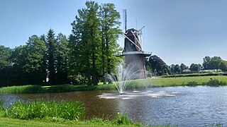 Pekelder Windmill "De Onrust" in Oude Pekela


References
- ^ a b "Burgemeester" [Mayor] (in Dutch). Gemeente Pekela. Archived from the original on 21 February 2014. Retrieved 3 February 2014.
- ^ a b "Kerncijfers wijken en buurten 2020" [Key figures for neighbourhoods 2020]. StatLine (in Dutch). CBS. 24 July 2020. Retrieved 19 September 2020.
- ^ "Postcodetool for 9665JD". Actueel Hoogtebestand Nederland (in Dutch). Het Waterschapshuis. Retrieved 3 February 2014.
- ^ a b "Bevolkingsontwikkeling; regio per maand" [Population growth; regions per month]. CBS Statline (in Dutch). CBS. 1 January 2021. Retrieved 2 January 2022.
- ^ "Pekela municipal election 2018". verkiezingsuitslagen.nl (in Dutch). 21 March 2018. Retrieved 14 May 2024.
- ^ "Pekela municipal election 2022". verkiezingsuitslagen.nl (in Dutch). 16 March 2022. Retrieved 14 May 2024.
- ^ "Jan de Boer". Olympedia (in Dutch). Retrieved 25 February 2022.
- ^ Gerrit Voerman (2013). "Meis, Frederik (1921-1992)". Biographical Dictionary of the Netherlands (in Dutch). Retrieved 25 February 2022.
- ^ "J.F. (Janneke) Snijder-Hazelhoff". Dutch Parliament (in Dutch). Retrieved 22 February 2022.
- ^ "Gerard Wiekens". World Football. Retrieved 25 February 2022.
External links
Wikimedia Commons has media related to Pekela.
- Official website

Places adjacent to Pekela | ||||||||||||||||
|---|---|---|---|---|---|---|---|---|---|---|---|---|---|---|---|---|
| ||||||||||||||||


- v
- t
- e
Populated places in the municipality of Pekela
- Boven Pekela [nl]
- Nieuwe Pekela
- Oude Pekela
- Alteveer
- Bronsveen [nl]
Municipalities of Groningen | ||
|---|---|---|
|  | |
| ||
| Authority control databases |
|
|---|


