Padstow Heights
Suburb of Sydney, New South Wales, Australia
| Padstow Heights Sydney, New South Wales | |||||||||||||||
|---|---|---|---|---|---|---|---|---|---|---|---|---|---|---|---|
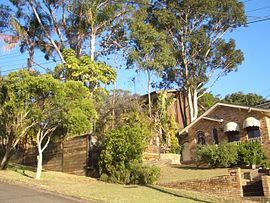 Henry Kendall Avenue, Padstow Heights | |||||||||||||||
 | |||||||||||||||
| Population | 3,540 (2016 census)[1] | ||||||||||||||
| Postcode(s) | 2211 | ||||||||||||||
| Elevation | 47 m (154 ft) | ||||||||||||||
| Location | 22 km (14 mi) south-west of Sydney central business district | ||||||||||||||
| LGA(s) | City of Canterbury-Bankstown | ||||||||||||||
| State electorate(s) | East Hills | ||||||||||||||
| Federal division(s) | Banks | ||||||||||||||
| |||||||||||||||
Padstow Heights, a suburb of local government area of the City of Canterbury-Bankstown, located 22 kilometres south-west of the Sydney central business district, in the state of New South Wales, Australia. It is a part of the South-western Sydney region. Padstow is a separate suburb to the north and One Tree Point is a locality within Padstow Heights.
Geography
Padstow Heights is a mostly residential suburb bounded on the east by Salt Pan Creek and to the south by the Georges River. The Alfords Point Bridge links Padstow Heights to Alfords Point in the Sutherland Shire.
Transport
U-Go Mobility bus route 927 from One Tree Point to Padstow railway station serves Padstow Heights.[2]
History

The Padstow area was first named Padstow Park Estate after a town called Padstow in Cornwall, England. It was named for being the "holy place of St Petrock" (not to be confused with St Patrick), an important Cornish saint.[3]
Padstow Heights within the City of Canterbury-Bankstown
Population
As per the 2016 Census, there were 3,540 people in Padstow Heights. 74.0% of people were born in Australia and 73.0% of people spoke only English at home. Other languages spoken at home included Greek 5.1% and Arabic 3.5%. The most common responses for religion were Catholic 30.3%, Anglican 18.5%, No Religion 14.9% and Eastern Orthodox 11.1%.[1]
Notable residents
- Jason Clare – Member for Blaxland in the federal parliament is currently living in Padstow Heights.[4]
- Roger Rogerson – former detective-sergeant of the New South Wales Police Force[5]
References
- ^ a b Australian Bureau of Statistics (27 June 2017). "Padstow Heights (State Suburb)". 2016 Census QuickStats. Retrieved 11 April 2018.

- ^ Route 927 Transport for NSW
- ^ The Book of Sydney Suburbs, Compiled by Frances Pollon, Angus & Robertson, 1990, Published in Australia ISBN 0-207-14495-8, page 197
- ^ Register of Members Interests Australian House of Representatives September 2016
- ^ The life of Roger Rogerson Sydney Morning Herald 15 June 2016
33°58′23″S 151°2′6″E / 33.97306°S 151.03500°E / -33.97306; 151.03500
Wikimedia Commons has media related to Padstow Heights, New South Wales.
- v
- t
- e
City of Canterbury Bankstown suburbs, localities, and other topics
within City of Canterbury Bankstown
- Ashbury
- Bankstown
- Bankstown Aerodrome
- Bass Hill
- Belfield
- Belmore
- Beverly Hills
- Birrong
- Campsie
- Canterbury
- Chester Hill
- Chullora
- Clemton Park
- Condell Park
- Croydon Park
- Earlwood
- East Hills
- Georges Hall
- Greenacre
- Hurlstone Park
- Kingsgrove
- Lakemba
- Lansdowne
- Leightonfield
- Milperra
- Mount Lewis
- Narwee
- Padstow
- Padstow Heights
- Panania
- Picnic Point
- Potts Hill
- Punchbowl
- Regents Park
- Revesby
- Revesby Heights
- Riverwood
- Roselands
- Sefton
- Undercliffe
- Villawood
- Wiley Park
- Yagoona
- 118th General Hospital (United States Army)
- Bankstown Bunker
- HMS Nabberley
- Milperra massacre
- No. 1 Fighter Sector RAAF
- Sydney gang rapes
- Airport line
- Bankstown Line
- Bankstown station
- Belmore station
- Birrong station
- Campsie station
- Canterbury station
- Chester Hill station
- East Hills station
- Hurlstone Park station
- Lakemba station
- Leightonfield station
- Padstow station
- Panania station
- Punchbowl station
- Revesby station
- Sefton station
- Villawood station
- Wiley Park station
- Yagoona station
public parks
past and present
- Josh Addo-Carr
- Bryan Brown
- John Burgess
- Paulini Curuenavuli
- Tyler De Nawi
- Alex Dimitriades
- Anh Do
- Casey Donovan
- Taj El-Din Hilaly
- Brett Emerton
- Blake Ferguson
- Mamdouh Habib
- John Howard
- Hard-Ons
- Brett Holman
- Paul Keating
- Terry Lamb
- Ken Moroney
- Kevin Moss
- Anthony Mundine
- Rebecca Rippon
- Geoff Robinson
- Akmal Saleh
- Bilal Skaf
- Vince Sorrenti
- Ian Thorpe
- Mark Waugh
- Steve Waugh
- Federal divisions
- State districts
- Ashfield Reservoir
- Bankstown Bites Food Festival
- Bankstown Central
- Bethungra, Canterbury
- Canterbury Bankstown region
- Chipping Norton Lake
- Cooks River Sewage Aqueduct
- Duck River (New South Wales)
- Earlwood Aboriginal Art Site
- Henry Lawson Drive
- King Georges Road
- Lakemba Mosque
- Meccano Set
- Old Sugarmill
- Pressure Tunnel and Shafts
- Roselands Shopping Centre
- The Homestead
- Wolli Creek Aqueduct
 | This article related to the geography of Sydney is a stub. You can help Wikipedia by expanding it. |
- v
- t
- e


