Mount Dyultydag
Mountain in Russia


Gora Dyultydag
Location of Dyultydag in the Caucasus mountains
Show map of Caucasus mountains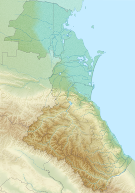
Gora Dyultydag
Gora Dyultydag (Republic of Dagestan)
Show map of Republic of Dagestan Dagestan
Caucasus Mountains
Gora Dyultydag, or simply Dyultydag (Russian: Дюльтыдаг), is a mountain located in Dagestan, Russia. At 4,127 m (13,540 ft) elevation, it is the highest point of the Dyultydag range of the Greater Caucasus.[1][3]
Toponymy
Dyultydag refers to both a mountain range[4] and its higher summit, Gora Dyultydag.[5]
Sometimes the Cyrillic name Дюльтыдаг is transliterated as Dyul'tydag.[6]
Geography
The mountain belongs to the Samur basin. Its peak stands about 15 km (9 mi) north of the border with Azerbaijan. The closest village to Dyultydag is Archib in Charodinsky District. In 1961 its summit was reported as perennial snow-capped.[5] At an elevation of 4127 m Gora Dyultydag is Dagestan's fifth-highest mountain and the 45th-highest in Russia.[6]
See also
 Russia portal
 Mountains portal


References
- ^ a b Soviet military map K-38-82 (1:100,000)
- ^ Гора Дюльтыдаг: Russia, web-page on www.geographic.org
- ^ Soviet military map K-38-23 (1:200,000)
- ^ Moscow University Geology Bulletin, Volume 35. Allerton Press. 1980.
- ^ a b Florinsky, Michael T. Florinsky (1961). McGraw-Hill encyclopedia of Russia and the Soviet Union. McGraw-Hill.
- ^ a b Gora Dyul'tydag, peakery.com
External links
- "Gora Dyultydag, Russia". Peakbagger.com.
- v
- t
- e
- Spain: Mulhacén
- Aneto
- Torre de Cerredo
- Almanzor — Massif Central: Puy de Sancy
- Canaries: Teide
- Roque de los Muchachos
- Pico de las Nieves
- Malpaso — Azores: Pico
- Madeira: Ruivo
- Mont Blanc
- Grossglockner
- Finsteraarhorn
- Wildspitze
- Bernina
- Hochkönig
- Dufourspitze
- Hoher Dachstein
- Marmolada
- Viso
- Triglav
- Barre des Écrins
- Säntis
- Ortler
- Baldo
- Gran Paradiso
- Coca
- Cima Dodici
- Dents du Midi
- Chamechaude
- Zugspitze
- Antelao
- Arcalod
- Grintovec
- Großer Priel
- Grigna Settentrionale
- Bondone
- Presanella
- Birnhorn
- Col Nudo
- Pointe Percée
- Jôf di Montasio
- Polinik
- Tödi
- Birkkarspitze
- Ellmauer Halt
- Grande Tête de l'Obiou
- Hochtor
- Grimming
- Grand Combin
- Tournette
- Zirbitzkogel
- Kesch
- Cima Brenta
- Corno Grande
- Amaro
- Serra Dolcedorme
- Montalto
- Cimone
- Carpathians: Gerlachovský štít
- Parângu Mare
- Moldoveanu
- Peleaga
- Pietrosul Rodnei — Crimea: Roman-Kosh — Urals: Narodnaya
- Musala
- Olympus
- Vihren
- Taygetus
- Korab
- Jezercë
- Athos
- Kyllini
- Ossa
- Papingu
- Pangaion Hills
- Kajmakčalan
- Smolikas
- Giona
- Jakupica
- Këndrevica
- Radomir
- Parnassus
- Botev
- Çika
- Valamara
- Baba
- Psili Koryfi
- Elbrus
- Bazardüzü
- Kazbek
- Tebulosmta
- Aragats
- Dykh-Tau
- Mount Dyultydag
- Kaputjugh
- Mount Addala-Shukhgelmeer
- Shani
 | This Republic of Dagestan location article is a stub. You can help Wikipedia by expanding it. |
- v
- t
- e


