Merrivale, KwaZulu-Natal
Place in KwaZulu-Natal, South Africa
Place in KwaZulu-Natal, South Africa
29°30′50″S 30°14′13″E / 29.514°S 30.237°E / -29.514; 30.237 (2011)[1]
3291
3291
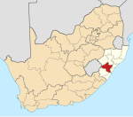
Merrivale is a town in Umgungundlovu District Municipality in the KwaZulu-Natal province of South Africa.
Village 145 km north-west of Durban and 5 km south-east of Howick. Named after Herman Merivale, Secretary of State for the Colonies in 1848.[2]
References
- ^ a b c d "Sub Place Merrivale". Census 2011.
- ^ "Dictionary of Southern African Place Names (Public Domain)". Human Science Research Council. p. 306.
- v
- t
- e
Municipalities and communities of uMgungundlovu District Municipality, KwaZulu-Natal
District seat: Pietermaritzburg
- Bruntville
- Mooi River
- Rosetta
- Townview, Mooi River
 | This KwaZulu-Natal location article is a stub. You can help Wikipedia by expanding it. |
- v
- t
- e


