Luna, Minnesota
Unincorporated community in Minnesota, United States
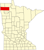
48°15′13″N 96°47′37″W / 48.25361°N 96.79361°W / 48.25361; -96.79361Luna is an unincorporated community in southern Marshall County, Minnesota, United States.[1][2]
The community lies approximately four miles north of Warren along U.S. Route 75.[3]
Climate
According to the Köppen Climate Classification system, Luna has a warm-summer humid continental climate, abbreviated "Dfb" on climate maps. The hottest temperature recorded in Luna was 101 °F (38.3 °C) on June 1942, while the coldest temperature recorded was −32 °F (−35.6 °C) on January 22, 1937, January 18, 1960, January 30, 1979, and December 23, 1990.[4]
| Climate data for Luna, Minnesota, 1991–2020 normals, extremes 1903–2015 | |||||||||||||
|---|---|---|---|---|---|---|---|---|---|---|---|---|---|
| Month | Jan | Feb | Mar | Apr | May | Jun | Jul | Aug | Sep | Oct | Nov | Dec | Year |
| Record high °F (°C) | 72 (22) | 76 (24) | 81 (27) | 89 (32) | 96 (36) | 101 (38) | 100 (38) | 97 (36) | 97 (36) | 87 (31) | 80 (27) | 73 (23) | 101 (38) |
| Mean maximum °F (°C) | 63.3 (17.4) | 64.8 (18.2) | 70.6 (21.4) | 77.2 (25.1) | 84.3 (29.1) | 91.5 (33.1) | 92.6 (33.7) | 88.2 (31.2) | 84.6 (29.2) | 78.4 (25.8) | 70.5 (21.4) | 64.2 (17.9) | 93.7 (34.3) |
| Mean daily maximum °F (°C) | 51.9 (11.1) | 54.6 (12.6) | 60.9 (16.1) | 67.2 (19.6) | 75.4 (24.1) | 85.0 (29.4) | 85.3 (29.6) | 81.8 (27.7) | 78.5 (25.8) | 71.0 (21.7) | 60.7 (15.9) | 52.3 (11.3) | 68.7 (20.4) |
| Daily mean °F (°C) | 32.7 (0.4) | 35.6 (2.0) | 40.1 (4.5) | 45.9 (7.7) | 52.5 (11.4) | 61.2 (16.2) | 66.4 (19.1) | 64.5 (18.1) | 58.8 (14.9) | 48.8 (9.3) | 39.3 (4.1) | 32.6 (0.3) | 48.2 (9.0) |
| Mean daily minimum °F (°C) | 13.5 (−10.3) | 16.5 (−8.6) | 19.3 (−7.1) | 24.5 (−4.2) | 29.7 (−1.3) | 37.4 (3.0) | 47.5 (8.6) | 47.2 (8.4) | 39.1 (3.9) | 26.7 (−2.9) | 18.0 (−7.8) | 13.0 (−10.6) | 27.7 (−2.4) |
| Mean minimum °F (°C) | −4.6 (−20.3) | −0.8 (−18.2) | 4.4 (−15.3) | 10.6 (−11.9) | 17.6 (−8.0) | 25.5 (−3.6) | 35.9 (2.2) | 38.0 (3.3) | 26.9 (−2.8) | 13.3 (−10.4) | 1.5 (−16.9) | −8.4 (−22.4) | −12.0 (−24.4) |
| Record low °F (°C) | −32 (−36) | −31 (−35) | −18 (−28) | −5 (−21) | 7 (−14) | 18 (−8) | 26 (−3) | 30 (−1) | 19 (−7) | 2 (−17) | −25 (−32) | −32 (−36) | −32 (−36) |
| Average precipitation inches (mm) | 1.21 (31) | 1.05 (27) | 0.82 (21) | 0.45 (11) | 0.68 (17) | 0.61 (15) | 3.37 (86) | 3.84 (98) | 2.16 (55) | 1.42 (36) | 0.86 (22) | 1.11 (28) | 17.58 (447) |
| Average snowfall inches (cm) | 5.4 (14) | 1.7 (4.3) | 1.4 (3.6) | 0.7 (1.8) | 0.0 (0.0) | 0.0 (0.0) | 0.0 (0.0) | 0.0 (0.0) | 0.0 (0.0) | 0.1 (0.25) | 1.4 (3.6) | 6.9 (18) | 17.6 (45.55) |
| Average precipitation days (≥ 0.01 in) | 5.3 | 4.7 | 4.6 | 3.2 | 3.8 | 4.0 | 15.3 | 15.4 | 8.2 | 4.9 | 3.8 | 5.0 | 78.2 |
| Average snowy days (≥ 0.1 in) | 2.4 | 1.5 | 1.3 | 0.7 | 0.0 | 0.0 | 0.0 | 0.0 | 0.0 | 0.1 | 0.7 | 2.4 | 9.1 |
| Source 1: NOAA[5] | |||||||||||||
| Source 2: XMACIS2 (mean maxima/minima 1981–2010)[4] | |||||||||||||
Notes
- ^ a b c "Luna, Minnesota". Geographic Names Information System. United States Geological Survey, United States Department of the Interior.
- ^ Minnesota Department of Transportation-Marshall County
- ^ Newfolden, MN, 7.5 Minute Topographic Quadrangle, USGS, 1982
- ^ a b "xmACIS2". National Oceanic and Atmospheric Administration. Retrieved February 21, 2023.
- ^ "U.S. Climate Normals Quick Access – Station: Luna RS, MN". National Oceanic and Atmospheric Administration. Retrieved February 21, 2023.
- v
- t
- e
Municipalities and communities of Marshall County, Minnesota, United States
County seat: Warren
- Agder
- Alma
- Augsburg
- Big Woods
- Bloomer
- Boxville
- Cedar
- Como
- Comstock
- Donnelly
- Eagle Point
- East Park
- East Valley
- Eckvoll
- Espelie
- Excel
- Foldahl
- Fork
- Grand Plain
- Holt
- Huntly
- Lincoln
- Linsell
- Marsh Grove
- McCrea
- Middle River
- Moose River
- Moylan
- Nelson Park
- New Folden
- New Maine
- New Solum
- Oak Park
- Parker
- Rollis
- Sinnott
- Spruce Valley
- Tamarac
- Thief Lake
- Valley
- Vega
- Veldt
- Viking
- Wanger
- Warrenton
- West Valley
- Whiteford
- Wright
communities
territory
reservation
‡This populated place also has portions in an adjacent county or counties
- Minnesota portal
- United States portal
This article about a location in Marshall County, Minnesota is a stub. You can help Wikipedia by expanding it. |
- v
- t
- e


