List of listed buildings in Blantyre, South Lanarkshire
This is a list of listed buildings in the parish of Blantyre in South Lanarkshire, Scotland.
Map all coordinates using OpenStreetMap
Download coordinates as:
- KML
- GPX (all coordinates)
- GPX (primary coordinates)
- GPX (secondary coordinates)
List
| Name | Location | Date Listed | Grid Ref. [note 1] | Geo-coordinates | Notes | LB Number [note 2] | Image |
|---|---|---|---|---|---|---|---|
| Bardykes | 55°47′55″N 4°06′27″W / 55.798503°N 4.10744°W / 55.798503; -4.10744 (Bardykes) | Category B | 5159 |  Upload Photo | |||
| Blantyre, Mayberry Place, St Joseph's Presbytery | 55°47′44″N 4°05′41″W / 55.795667°N 4.094587°W / 55.795667; -4.094587 (Blantyre, Mayberry Place, St Joseph's Presbytery) | Category B | 50017 | Upload Photo | |||
| Glasgow Road, Livingstone Memorial Church Including Hall, Boundary Wall And Manse | 55°47′43″N 4°05′45″W / 55.795331°N 4.095814°W / 55.795331; -4.095814 (Glasgow Road, Livingstone Memorial Church Including Hall, Boundary Wall And Manse) | Category B | 6589 | Upload Photo | |||
| Old Churchyard | 55°47′05″N 4°06′26″W / 55.784728°N 4.10727°W / 55.784728; -4.10727 (Old Churchyard) | Category B | 5157 | Upload Photo | |||
| Calderglen | 55°48′39″N 4°06′37″W / 55.810792°N 4.110338°W / 55.810792; -4.110338 (Calderglen) | Category B | 5161 | Upload Photo | |||
| Blantyre, Mayberry Place, St Joseph's Catholic Church Including Boundary Walls, Gatepiers And Railings | 55°47′42″N 4°05′43″W / 55.794909°N 4.095297°W / 55.794909; -4.095297 (Blantyre, Mayberry Place, St Joseph's Catholic Church Including Boundary Walls, Gatepiers And Railings) | Category B | 50018 | Upload Photo | |||
| Parish Church | 55°47′04″N 4°06′28″W / 55.784523°N 4.107721°W / 55.784523; -4.107721 (Parish Church) | Category B | 5156 | Upload Photo | |||
| The Wages Office, Blantyre Mill | 55°48′07″N 4°04′57″W / 55.802029°N 4.082468°W / 55.802029; -4.082468 (The Wages Office, Blantyre Mill) | Category B | 5163 | Upload Photo | |||
| Shott House | 55°47′05″N 4°06′39″W / 55.784677°N 4.110776°W / 55.784677; -4.110776 (Shott House) | Category B | 5158 | Upload Photo | |||
| Haughhead Bridge | 55°49′46″N 4°06′03″W / 55.829359°N 4.100965°W / 55.829359; -4.100965 (Haughhead Bridge) | Category B | 5165 |  Upload another image | |||
| Blantyre Priory | 55°48′35″N 4°05′53″W / 55.809769°N 4.09817°W / 55.809769; -4.09817 (Blantyre Priory) | Category B | 5160 | Upload Photo | |||
| Mill House, Blantyre | 55°48′09″N 4°04′57″W / 55.80262°N 4.082579°W / 55.80262; -4.082579 (Mill House, Blantyre) | Category B | 5164 | Upload Photo | |||
| Scottish National Memorial To David Livingstone | 55°48′08″N 4°05′00″W / 55.802256°N 4.083357°W / 55.802256; -4.083357 (Scottish National Memorial To David Livingstone) | Category A | 5162 | 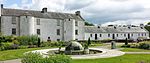 Upload another image | |||
| Memorial Bridge | 55°48′07″N 4°04′54″W / 55.801935°N 4.081633°W / 55.801935; -4.081633 (Memorial Bridge) | Category B | 89 | Upload Photo |
Key
The scheme for classifying buildings in Scotland is:
- Category A: "buildings of national or international importance, either architectural or historic; or fine, little-altered examples of some particular period, style or building type."[1]
- Category B: "buildings of regional or more than local importance; or major examples of some particular period, style or building type, which may have been altered."[1]
- Category C: "buildings of local importance; lesser examples of any period, style, or building type, as originally constructed or moderately altered; and simple traditional buildings which group well with other listed buildings."[1]
In March 2016 there were 47,288 listed buildings in Scotland. Of these, 8% were Category A, and 50% were Category B, with the remaining 42% being Category C.[2]
Notes
- ^ Sometimes known as OSGB36, the grid reference (where provided) is based on the British national grid reference system used by the Ordnance Survey.
• "Guide to National Grid". Ordnance Survey. Retrieved 12 December 2007.
• "Get-a-map". Ordnance Survey. Retrieved 17 December 2007. - ^ Historic Environment Scotland assign a unique alphanumeric identifier to each designated site in Scotland, for listed buildings this always begins with "LB", for example "LB12345".
References
- All entries, addresses and coordinates are based on data from Historic Scotland. This data falls under the Open Government Licence
External links
- Listed Buildings in Blantyre Ward, South Lanarkshire at British Listed Buildings
- ^ a b c "What is Listing?". Historic Environment Scotland. Retrieved 29 May 2018.
- ^ Scotland's Historic Environment Audit 2016 (PDF). Historic Environment Scotland and the Built Environment Forum Scotland. pp. 15–16. Retrieved 29 May 2018.
- v
- t
- e
- All in Category A
- Avondale
- Biggar
- Blantyre
- Bothwell
- Cambuslang
- Carluke
- Carmichael
- Carmunnock
- Carnwath
- Carstairs
- Covington
- Crawford
- Crawfordjohn
- Culter
- Dalserf
- Dolphinton
- Douglas
- Dunsyre
- East Kilbride
- Glassford
- Hamilton
- Lanark
- Lesmahagow
- Libberton
- Pettinain
- Rutherglen
- Stonehouse
- Symington
- Walston
- Wandel And Lamington
- Wiston And Roberton


