Hoye-Crest
Summit in Maryland, United States

Hoye-Crest
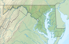
Garrett County, Maryland
Hoye-Crest is a summit along Backbone Mountain just inside of Garrett County, Maryland. It is the highest natural point in Maryland at an elevation of 3,360 feet (1,020 m).[3]
The location, named for Captain Charles E. Hoye (1876–1951), founder of the Garrett County Historical Society, offers a view of the North Branch Potomac River valley to the east. The Maryland Historical Society placed a historical marker at the summit during a dedication ceremony in September 1952.
Accessing Hoye-Crest
There is no vehicular access to Hoye-Crest. The best route by foot is a hike along the Maryland High Point Trail, from a point along U.S. Route 219 just south of Silver Lake, West Virginia at 39°14′43″N 79°29′30″W / 39.24528°N 79.49167°W / 39.24528; -79.49167. The trail ascends Backbone Mountain along an old logging road on Monongahela National Forest property to the West Virginia-Maryland state line. The distance is about one mile each way. The trail then heads north along the state line to the high point. Hoye-Crest sits on private property (Western Pocahontas Properties), though access is permitted.
See also
 Geography portal
 North America portal
 United States portal
 Maryland portal
 Mountains portal


- List of U.S. states by elevation
- Backbone Mountain
- Monongahela National Forest
- Meshach Browning
References
- ^ a b "Backbone Mountain, Maryland". Peakbagger.com. Retrieved 2012-11-08.
- ^ "Hoye-Crest". Geographic Names Information System. United States Geological Survey, United States Department of the Interior. Retrieved 2012-11-08.
- ^ "Backbone Mountain". SummitPost.org. Retrieved 2008-06-02.
External links
- "Backbone Mountain". SummitPost.org.
- v
- t
- e
- Backbone Mountain
- Dans Mountain
- Haystack Mountain
- Negro Mountain
- Roundtop Hill
- Catoctin Mountain
- Elk Ridge
- Lambs Knoll
- Quirauk Mountain
- South Mountain
- Sugarloaf Mountain
| ||
|---|---|---|
| States |
|   |
| District | ||
| Territories |
| |


