Horstmar
Town in North Rhine-Westphalia, Germany

Flag

Coat of arms
Location of Horstmar within Steinfurt district

(2022-12-31)[2]
48612
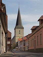
Horstmar is a German town, located in North Rhine-Westphalia in the Steinfurt district, approx. 25 km (16 mi) north-west of Münster.
History
Its castle was built as early as the 9th century; the first mention of Horstmar is as early as the early 11th century. The city of Horstmar was built to the south of this castle. During the Thirty Years' War the castle was destroyed by order of the Hessian lieutenant Carl von Rabenhaupt.
Politics
The city council consists of 22 councillors and the mayor.
People from Horstmar
- Clemens Freiherr von Schorlemer-Lieser (1856-1922), German politician
References
- ^ Wahlergebnisse in NRW Kommunalwahlen 2020, Land Nordrhein-Westfalen, accessed 30 June 2021.
- ^ "Bevölkerung der Gemeinden Nordrhein-Westfalens am 31. Dezember 2022 – Fortschreibung des Bevölkerungsstandes auf Basis des Zensus vom 9. Mai 2011" (in German). Landesbetrieb Information und Technik NRW. Retrieved 20 June 2023.
- v
- t
- e
Towns and municipalities in Steinfurt (district)
- Altenberge
- Emsdetten
- Greven
- Hopsten
- Hörstel
- Horstmar
- Ibbenbüren
- Ladbergen
- Laer
- Lengerich
- Lienen
- Lotte
- Metelen
- Mettingen
- Neuenkirchen
- Nordwalde
- Ochtrup
- Recke
- Rheine
- Saerbeck
- Steinfurt
- Tecklenburg
- Westerkappeln
- Wettringen

Authority control databases | |
|---|---|
| International |
|
| National |
|
| This Steinfurt district location article is a stub. You can help Wikipedia by expanding it. |
- v
- t
- e


