Horní Loděnice
Municipality in Olomouc, Czech Republic

Flag

Coat of arms
 Czech Republic
 (2023-01-01)[1]
783 05
Horní Loděnice (until 1950 Německá Loděnice; German: Deutsch Lodenitz) is a municipality and village in Olomouc District in the Olomouc Region of the Czech Republic. It has about 300 inhabitants.
Horní Loděnice lies approximately 22 kilometres (14 mi) north-east of Olomouc and 214 km (133 mi) east of Prague.
Demographics
| Year | Pop. | ±% |
|---|---|---|
| 1869 | 984 | — |
| 1880 | 975 | −0.9% |
| 1890 | 922 | −5.4% |
| 1900 | 830 | −10.0% |
| 1910 | 798 | −3.9% |
| 1921 | 781 | −2.1% |
| 1930 | 778 | −0.4% |
| 1950 | 305 | −60.8% |
| 1961 | 376 | +23.3% |
| 1970 | 386 | +2.7% |
| 1980 | 309 | −19.9% |
| 1991 | 302 | −2.3% |
| 2001 | 336 | +11.3% |
| 2011 | 323 | −3.9% |
| 2021 | 300 | −7.1% |
| Source: Censuses[2][3] | ||
Gallery
-
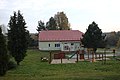 Playground and municipal office
 -
 Road
Road -
 Houses


References
- ^ "Population of Municipalities – 1 January 2023". Czech Statistical Office. 2023-05-23.
- ^ "Historický lexikon obcí České republiky 1869–2011 – Okres Olomouc" (in Czech). Czech Statistical Office. 2015-12-21. pp. 5–6.
- ^ "Population Census 2021: Population by sex". Public Database. Czech Statistical Office. 2021-03-27.
External links
Wikimedia Commons has media related to Horní Loděnice.
- Official website
- v
- t
- e
Towns, market towns and villages of Olomouc District
- Babice
- Bělkovice-Lašťany
- Bílá Lhota
- Bílsko
- Blatec
- Bohuňovice
- Bouzov
- Bukovany
- Bystročice
- Bystrovany
- Červenka
- Charváty
- Cholina
- Daskabát
- Dlouhá Loučka
- Dolany
- Doloplazy
- Domašov nad Bystřicí
- Domašov u Šternberka
- Drahanovice
- Dub nad Moravou
- Dubčany
- Grygov
- Haňovice
- Hlásnice
- Hlubočky
- Hlušovice
- Hněvotín
- Hnojice
- Horka nad Moravou
- Horní Loděnice
- Hraničné Petrovice
- Huzová
- Jívová
- Komárov
- Kozlov
- Kožušany-Tážaly
- Krčmaň
- Křelov-Břuchotín
- Liboš
- Lipina
- Lipinka
- Litovel
- Loučany
- Loučka
- Luběnice
- Luká
- Lutín
- Lužice
- Majetín
- Medlov
- Měrotín
- Město Libavá
- Mladeč
- Mladějovice
- Moravský Beroun
- Mrsklesy
- Mutkov
- Náklo
- Náměšť na Hané
- Norberčany
- Nová Hradečná
- Olbramice
- Olomouc
- Paseka
- Pňovice
- Přáslavice
- Příkazy
- Řídeč
- Samotišky
- Senice na Hané
- Senička
- Skrbeň
- Slatinice
- Slavětín
- Štarnov
- Štěpánov
- Šternberk
- Strukov
- Střeň
- Suchonice
- Šumvald
- Svésedlice
- Těšetice
- Tovéř
- Troubelice
- Tršice
- Újezd
- Uničov
- Ústín
- Velká Bystřice
- Velký Týnec
- Velký Újezd
- Věrovany
- Vilémov
- Želechovice
- Žerotín
Authority control databases | |
|---|---|
| International |
|
| National |
|
 | This Olomouc Region location article is a stub. You can help Wikipedia by expanding it. |
- v
- t
- e


