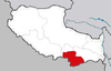
Gyaca County
County in Tibet, China
Gyaca County 29°8′35″N 92°35′31″E / 29.14306°N 92.59194°E / 29.14306; 92.59194 | |
|---|---|
| Country | China |
| Autonomous region | Tibet |
| Prefecture-level city | Shannan (Lhoka) |
| County seat | Gyaca |
| Area | |
| • Total | 4,388.26 km2 (1,694.32 sq mi) |
| Population (2020)[1] | |
| • Total | 23,534 |
| • Density | 5.4/km2 (14/sq mi) |
| Time zone | UTC+8 (China Standard) |
| Website | www |
| Gyaca County | |||||||
|---|---|---|---|---|---|---|---|
| Chinese name | |||||||
| Simplified Chinese | 加查县 | ||||||
| Traditional Chinese | 加查縣 | ||||||
| |||||||
| Tibetan name | |||||||
| Tibetan | རྒྱ་ཚ་རྫོང་། | ||||||
| |||||||
Gyaca County (Tibetan: རྒྱ་ཚ་རྫོང་།; Chinese: 加查县) is a county of Shannan located in the south-east of the Tibet Autonomous Region, China.
Gyatsa County is in the south of Tibet, stretching from the Podrang La pass along the southern side of the Brahmaputra River downstream to Pamda which is just to the southwest of Daklha Gampo, across the Brahmaputra. The county capital is in the town of Gyaca or Drumpa (46 km or 29 mi west of Pamda) which is alongside the Drakpo Dratsang Monastery. It is renowned for its walnuts and apricots.[2]
Lhamo La-tso is the name of a small oval lake in the area. It is also called "Oracle Lake", as it is where senior Tibetan monks go for visions to assist in the discovery of reincarnations of the Dalai Lamas is located in Gyaca County.
Administrative divisions
Gyaca County contains 2 towns and 5 townships.
| Name | Chinese | Hanyu Pinyin | Tibetan | Wylie |
|---|---|---|---|---|
| Towns | ||||
| Gyaca Town | 加查镇 | Jiāchá zhèn | རྒྱ་ཚ་གྲོང་རྡལ། | rgya tsha grong rdal |
| Ngarrab Town | 安绕镇 | Ānrào zhèn | མངར་རབ་གྲོང་རྡལ། | mngar rab grong rdal |
| Townships | ||||
| Lhasöl Township | 拉绥乡 | Lāsuí xiāng | ལྷ་གསོལ་ཤང་། | lha gsol shang |
| Chêju Township | 崔久乡 | Cuījiǔ xiāng | ཆེས་བཅུ་ཤང་། | ches bcu shang |
| Ba Township | 坝乡 | Bà xiāng | སྦྲ་ཤང་། | sbra shang |
| Lingda Township | 冷达乡 | Lěngdá xiāng | གླིང་མདའ་ཤང་། | gling mda' shang |
| Lholing Township | 洛林乡 | Luòlín xiāng | ལྷོ་གླིང་ཤང་། | lho gling shang |
Climate
| Climate data for Gyaca (1991–2020 normals) | |||||||||||||
|---|---|---|---|---|---|---|---|---|---|---|---|---|---|
| Month | Jan | Feb | Mar | Apr | May | Jun | Jul | Aug | Sep | Oct | Nov | Dec | Year |
| Mean daily maximum °C (°F) | 10.9 (51.6) | 13.3 (55.9) | 16.1 (61.0) | 18.9 (66.0) | 22.1 (71.8) | 25.1 (77.2) | 24.6 (76.3) | 24.0 (75.2) | 22.9 (73.2) | 20.2 (68.4) | 16.1 (61.0) | 12.1 (53.8) | 18.9 (66.0) |
| Daily mean °C (°F) | 0.5 (32.9) | 3.5 (38.3) | 7.0 (44.6) | 10.1 (50.2) | 13.6 (56.5) | 16.7 (62.1) | 16.9 (62.4) | 16.4 (61.5) | 14.9 (58.8) | 10.7 (51.3) | 5.1 (41.2) | 1.0 (33.8) | 9.7 (49.5) |
| Mean daily minimum °C (°F) | −7.9 (17.8) | −5.1 (22.8) | −0.9 (30.4) | 3.0 (37.4) | 7.1 (44.8) | 11.2 (52.2) | 12.3 (54.1) | 11.8 (53.2) | 10.1 (50.2) | 3.8 (38.8) | −2.8 (27.0) | −7.0 (19.4) | 3.0 (37.3) |
| Average precipitation mm (inches) | 1.2 (0.05) | 2.4 (0.09) | 10.4 (0.41) | 24.0 (0.94) | 44.3 (1.74) | 84.8 (3.34) | 149.6 (5.89) | 124.2 (4.89) | 66.9 (2.63) | 13.5 (0.53) | 2.7 (0.11) | 0.4 (0.02) | 524.4 (20.64) |
| Average precipitation days (≥ 0.1 mm) | 1.1 | 1.9 | 5.5 | 10.1 | 14.3 | 19.8 | 23.8 | 22.1 | 18.2 | 5.0 | 1.6 | 0.3 | 123.7 |
| Average snowy days | 2.1 | 3.6 | 6.9 | 2.2 | 0.2 | 0 | 0 | 0 | 0 | 0.3 | 1.4 | 1.1 | 17.8 |
| Average relative humidity (%) | 32 | 33 | 39 | 46 | 52 | 60 | 69 | 69 | 67 | 53 | 40 | 36 | 50 |
| Mean monthly sunshine hours | 234.2 | 223.1 | 234.2 | 225.5 | 226.5 | 200.5 | 182.2 | 190.1 | 197.2 | 245.6 | 245.6 | 233.3 | 2,638 |
| Percent possible sunshine | 72 | 70 | 63 | 58 | 54 | 48 | 43 | 47 | 54 | 70 | 77 | 73 | 61 |
| Source: China Meteorological Administration[3][4] | |||||||||||||
Footnotes
- ^ Tibet: Prefectures, Cities, Districts and Counties
- ^ Gyurme Dorje (1999). Tibet Handbook with Bhutan (2nd ed.). Bath, UK: Footprint Handbooks. p. 230. ISBN 978-1-900949-33-0.
- ^ 中国气象数据网 – WeatherBk Data (in Simplified Chinese). China Meteorological Administration. Retrieved 27 September 2023.
- ^ 中国气象数据网 (in Simplified Chinese). China Meteorological Administration. Retrieved 27 September 2023.
External links
- Gyaca County Annals
- v
- t
- e
Lhasa (capital)
cities
| Lhasa | |
|---|---|
| Xigazê | |
| Qamdo | |
| Nyingchi | |
| Shannan | |
| Nagqu |
| Ngari |
|---|
** Southern portions of these counties are claimed by the People's Republic of China as part of the South Tibet area, but are administered by India.
 | This Shannan, Tibet location article is a stub. You can help Wikipedia by expanding it. |
- v
- t
- e


