Dado, Afghanistan
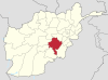
Place in Ghazni, Afghanistan
33°40′5″N 68°36′3″E / 33.66806°N 68.60083°E / 33.66806; 68.60083 Afghanistan
Dado is the district center of Zana Khan district, Afghanistan. It is located 30 km north-east of Ghazni on 33°40′05″N 68°36′03″E / 33.6681°N 68.6008°E / 33.6681; 68.6008 at 2,520 m altitude.[1]
The town is located within the heartland of the Andar tribe of Ghilji Pashtuns.[2]
Climate
Dado has a humid continental climate (Köppen climate classification: Dsb) with warm, dry summers and cold, snowy winters.
| Climate data for Dado, Ghazni Province | |||||||||||||
|---|---|---|---|---|---|---|---|---|---|---|---|---|---|
| Month | Jan | Feb | Mar | Apr | May | Jun | Jul | Aug | Sep | Oct | Nov | Dec | Year |
| Daily mean °C (°F) | −7.7 (18.1) | −4.4 (24.1) | 1.4 (34.5) | 8.3 (46.9) | 13.8 (56.8) | 18.1 (64.6) | 20.2 (68.4) | 19.1 (66.4) | 15.0 (59.0) | 8.7 (47.7) | 2.0 (35.6) | −3.7 (25.3) | 7.6 (45.6) |
| Average precipitation mm (inches) | 43.4 (1.71) | 89.3 (3.52) | 78.3 (3.08) | 56.8 (2.24) | 36.5 (1.44) | 9.4 (0.37) | 22.0 (0.87) | 16.2 (0.64) | 4.5 (0.18) | 6.0 (0.24) | 33.9 (1.33) | 13.4 (0.53) | 409.7 (16.15) |
| Average relative humidity (%) | 56 | 65 | 52 | 36 | 28 | 21 | 24 | 26 | 20 | 23 | 38 | 40 | 36 |
| Source 1: ClimateCharts[3] | |||||||||||||
| Source 2: World Weather Online (precipitation & humidity)[4] | |||||||||||||
See also
- Ghazni Province
References
- ^ Dado can be found at GEOnet Names Server, at this link, by opening the Advanced Search box, entering "-3372574" in the "Unique Feature Id" form, and clicking on "Search Database".
- ^ Ghazni Province Tribal Map (Page 4). Naval Postgraduate School.
- ^ "Climate: Dado - ClimateCharts, Laura Zepner, Pierre Karrasch, Felix Wiemann & Lars Bernard (2020) ClimateCharts.net – an interactive climate analysis web platform, International Journal of Digital Earth, DOI: 10.1080/17538947.2020.1829112". Retrieved 24 September 2022.
- ^ "Humidity: Dado - World Weather Online". Retrieved 24 September 2022.
- v
- t
- e
Ghazni Province
Capital: Ghazni
- Ab Band
- Almaytu
- Andar
- Anguri
- Binisang
- Dado
- Du Abi
- Espandi 'Olya
- Gulbawri
- Haji Khel
- Janda
- Jermatu
- Kakrak Valley
- Khogyani
- Khwaja Umari
- Loman
- Malistan
- Mir Adina
- Miray
- Muqur
- Nani
- Nawa
- Pana
- Qarabagh
- Qolyaqol
- Qyaq Valley
- Ramak
- Sang-e-Masha
- Sangar
- Sarab
- Sardeh Band
- Shaki Valley
- Tamaki
- Turgan Valley
- Zargari
 | This Ghazni Province, Afghanistan location article is a stub. You can help Wikipedia by expanding it. |
- v
- t
- e


