Crampton's Gap
Wind gap on South Mountain in Maryland
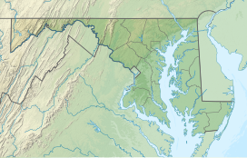

Location of the gap in Maryland
Crampton's Gap, also known as Crampton Gap, is a wind gap on South Mountain in Maryland.
The 928 feet (283 m) gap connects Burkittsville in the Middletown Valley to the east with Gapland and Rohrersville in the Pleasant Valley to the west.
Documentation of the earliest land tracts in the Crampton's Gap area and records related to the earliest road may be found in The Land Tracts of the Battlefield of South Mountain by Curtis L. Older.[3]
The gap is the location of Gathland State Park and was the site of the Battle of Crampton's Gap on September 14, 1862, during the Maryland Campaign of the American Civil War.

References
External links
- topo map
- Gathland State Park
- v
- t
- e
Gaps of the Appalachian Mountains
- Cumberland Narrows
- Brocks Gap
- Delaware Water Gap
- Gaps of the Allegheny
- Blair Gap
- Kittanning Gap
- Goshen Pass
- Hillsboro Gap
- James River Gorge
- Lehigh Gap
- Loysburg Gap
- Mechanicsburg Gap
- Moccasin Gap
- The Narrows
- Potomac Water Gap
- Reeds Gap
- Schuylkill Gap
- Swatara Gap
- Thoroughfare Gap
- Appalachian Gap
- Balsam Gap
- Brock Gap
- Buck Creek Gap
- Bull Gap
- Carter Notch
- Cowee Gap
- Craven Gap
- Crawford Notch
- Deals Gap
- Dixville Notch
- Evans Notch
- Franconia Notch
- Gillespie Gap
- Grafton Notch
- Grandmother Gap
- Granville Notch
- Hazen's Notch
- Hobart Gap
- Kinsman Notch
- Lincoln Gap
- Mahoosuc Notch
- Middlebury Gap
- Monterey Pass
- Newfound Gap
- Pinkham Notch
- Sherburne Pass
- Skinners Gap
- Smugglers Notch
- Soco Gap
- Stony Clove Notch
- Zealand Notch
| Authority control databases: National |
|
|---|


