Coruripe
You can help expand this article with text translated from the corresponding article in Portuguese. (December 2023) Click [show] for important translation instructions.
- Machine translation, like DeepL or Google Translate, is a useful starting point for translations, but translators must revise errors as necessary and confirm that the translation is accurate, rather than simply copy-pasting machine-translated text into the English Wikipedia.
- Consider adding a topic to this template: there are already 1,528 articles in the main category, and specifying
|topic=will aid in categorization. - Do not translate text that appears unreliable or low-quality. If possible, verify the text with references provided in the foreign-language article.
- You must provide copyright attribution in the edit summary accompanying your translation by providing an interlanguage link to the source of your translation. A model attribution edit summary is
Content in this edit is translated from the existing Portuguese Wikipedia article at [[:pt:Coruripe]]; see its history for attribution. - You may also add the template
{{Translated|pt|Coruripe}}to the talk page. - For more guidance, see Wikipedia:Translation.
Municipality in Alagoas, Brazil

Flag

Seal
"Land of the Caetés"
"Trabalho e Progresso" ("Work and Progress")

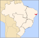
Location of Coruripe in the State of Alagoas
 Brazil
 Alagoas
 (2020)
10°07′33″S 36°10′33″W / 10.12583°S 36.17583°W / -10.12583; -36.17583 Coruripe is a municipality located in the southern coast of the Brazilian state of Alagoas. Its population is 57,294 (2020)[2] and its area is 913 km2.[3] It is the largest municipality in Alagoas by area, but among the largest municipalities of each Brazilian state, it is the smallest. It is situated at the edge of Coruripe river.
References
- v
- t
- e

Capital: Maceió
 | This Alagoas, Brazil location article is a stub. You can help Wikipedia by expanding it. |
- v
- t
- e


