Comodoro
Municipality in Center-West, Brazil

Flag

Seal
"New West"
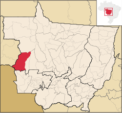
Location of Comodoro
 Brazil
 (2020 [1])
78310-000
Comodoro is a municipality in the state of Mato Grosso in the Central-West Region of Brazil.[2][3][4][5]
See also
References
- ^ IBGE 2020
- ^ "Divisão Territorial do Brasil" (in Portuguese). Divisão Territorial do Brasil e Limites Territoriais, Instituto Brasileiro de Geografia e Estatística (IBGE). July 1, 2008. Retrieved December 17, 2009.
- ^ "Estimativas da população para 1º de julho de 2009" (PDF) (in Portuguese). Estimativas de População, Instituto Brasileiro de Geografia e Estatística (IBGE). August 14, 2009. Archived from the original (PDF) on August 7, 2013. Retrieved December 17, 2009.
- ^ "Ranking decrescente do IDH-M dos municípios do Brasil" (in Portuguese). Atlas do Desenvolvimento Humano, Programa das Nações Unidas para o Desenvolvimento (PNUD). 2000. Archived from the original on October 3, 2009. Retrieved December 17, 2009.
- ^ "Produto Interno Bruto dos Municípios 2002-2005" (PDF) (in Portuguese). Instituto Brasileiro de Geografia e Estatística (IBGE). December 19, 2007. Archived from the original (PDF) on October 2, 2008. Retrieved December 17, 2009.
- v
- t
- e
Capital: Cuiabá
| Alto Pantanal | |
|---|---|
| Alto Paraguai | |
| Cuiabá | |
| Rosario Oeste |

| Canarana | |
|---|---|
| Medio Araguaia | |
| Norte Araguaia |
| Alta Floresta | |
|---|---|
| Alto Teles Pires | |
| Arinos | |
| Aripuanã | |
| Colíder | |
| Paranatinga | |
| Parecis | |
| Sinop |
| Alto Araguaia | |
|---|---|
| Primavera do Leste | |
| Rondonópolis | |
| Tesouro |
| Alto Guaporé | |
|---|---|
| Jauru | |
| Tangará da Serra |
13°39′S 59°47′W / 13.650°S 59.783°W / -13.650; -59.783
 | This Mato Grosso, Brazil location article is a stub. You can help Wikipedia by expanding it. |
- v
- t
- e


