Candarave Province
Province in Tacna, Peru

Flag

Coat of arms
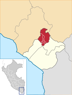
Location of Candarave in the Tacna Region
Candarave Province is the smallest of four provinces in the Tacna Region in southern Peru. Its capital is Candarave.
Boundaries
- North: Moquegua Region
- East: Puno Region
- South: Tarata Province
- West: Jorge Basadre Province
Geography
Some of the highest peaks of the province are Tutupaka and Yukamani, both are active volcanoes. Other mountains are listed below:[1]
- Apachita Limani
- Arichuwa
- Chinchillani
- Chuqi Ananta
- Churi Laq'a
- Churi Wiqu
- Ch'alla Q'awa
- Ch'alluma
- Ch'ankha Qullu
- Ch'ankhani
- Ch'iyar Jaqhi
- Iru Uma
- Jichu Qullu
- Jisk'a Larqanku
- Kuntur Ikiña
- K'ank'awi
- K'ara K'ara
- Larqanku
- Nasa Parqu
- Panti Usu
- Paxsi Awki
- Phaq'u Muqu
- Phaq'u Q'awa
- Pharaquta
- Qina Mich'i
- Qupa Phuju
- Qura Jawi
- Salla Jaqhi
- Sasawini
- Taypi Sirka
- Titini
- Tutupaka (Moquegua-Tacna)
- Wañuma
- Warintapani
- Watañani
- Waytiri
- Wila Qullu
- Wila Wilani
- Wisk'acha
- Yunkani
Political division
The province is divided into six districts (Spanish: distritos, singular: distrito), each of which is headed by a mayor (alcalde):
Ethnic groups
The province is inhabited by indigenous citizens of Aymara descent. Spanish, however, is the language which the majority of the population (78.17%) learnt to speak in childhood, 20.94% of the residents started speaking using the Aymara language (2007 Peru Census).[2]
See also
- Pharaquta
References
- ^ escale.minedu.gob.pe - UGEL map of the Candarave Province (Tacna Region)
- ^ inei.gob.pe Archived January 27, 2013, at the Wayback Machine INEI, Peru, Censos Nacionales 2007

| Authority control databases |
|
|---|
17°16′13″S 70°15′06″W / 17.270150°S 70.251625°W / -17.270150; -70.251625
 | This Tacna Region geography article is a stub. You can help Wikipedia by expanding it. |
- v
- t
- e


