Bartonsville, Virginia
Unincorporated community in Virginia, United States
Unincorporated community in Virginia, United States
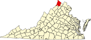
39°6′41″N 78°12′43″W / 39.11139°N 78.21194°W / 39.11139; -78.21194Bartonsville is an unincorporated community located along Opequon Creek in Frederick County, Virginia between Winchester and Stephens City. Bartonsville is on Springdale Road (SR 649) to the west of Valley Pike (US 11). Historically, it has been referred to as Barton's Mill and Bartonville. The area of Bartonsville was first settled by the Hite Family in 1733. During the American Civil War, the village was garrisoned with a small stone fort of unknown location held by the Union Army.
Historic sites
- Springdale (John Hite House) (1753)
- Springdale Mill Complex (1788)
References
- ^ U.S. Geological Survey Geographic Names Information System: Bartonsville, Virginia
Wikimedia Commons has media related to Bartonville, Virginia.
- v
- t
- e
Municipalities and communities of Frederick County, Virginia, United States
County seat: Winchester
communities
- Albin
- Armel
- Bartonsville
- Burnt Factory
- Canterburg
- Cedar Grove
- Cedar Hill
- Clear Brook
- Cross Junction
- De Haven
- Gainesboro
- Gravel Springs
- Green Spring
- Grimes
- Hayfield
- Indian Hollow
- Jordan Springs
- Kernstown
- Kline's Mill
- Leetown
- Marlboro
- McQuire
- Meadow Mills
- Mount Pleasant
- Mount Williams
- Mountain Falls
- Mountain Falls Park
- Nain
- Opequon
- Parkins Mills
- Rest
- Reynolds Store
- Ridings Mill
- Rock Enon Springs
- Round Hill
- Shockeysville
- Siler
- Star Tannery
- Stephenson
- Vaucluse
- Welltown
- Whitacre
- White Hall
- Wilde Acres
- Virginia portal
- United States portal
 | This Frederick County, Virginia state location article is a stub. You can help Wikipedia by expanding it. |
- v
- t
- e


