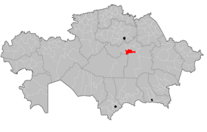
Abay District, Karaganda Region
District in Karaganda Region, Kazakhstan
Abay | |
|---|---|
District | |
| Абай ауданы | |
 | |
| Country | Kazakhstan |
| Region | Karaganda Region |
| Administrative center | Abay |
| Founded | 1973 |
| Government | |
| • Akim | Asanov Baurzhan Konirbaevich[1] |
| Area | |
| • Total | 25,000 sq mi (65,000 km2) |
| Population (2019) | |
| • Total | 58 673 |
| Time zone | UTC+6 (East) |
Abay District (Kazakh: Абай ауданы, Abai audany) is a district of Karaganda Region in central Kazakhstan. The administrative center of the district is the town of Abay.[2] Population: 54,057 (2013 estimate);[3] 53,214 (2009 Census results);[4] 65,306 (1999 Census results).[4]
History
Abay District was formed in March 21, 1973, under the name Michurinsky District, with the administrative center in the settlement of Topar. In 1997 it was renamed 'Abaysky' District and its administrative center was moved to the town of Abay.[5]
Population
The population is 58,673 (2019)
National composition (at the beginning of 2019):
- Russians – 23,587 people (40.20%)
- Kazakhs – 23,195 people (39.53%)
- Ukrainians – 3168 people (5.40%)
- Tatars – 2155 people (3.67%)
- Germans – 1981 people (3.38%)
- Belarusians – 1047 people (1.78%)
- Bashkirs – 471 people. (0.80%)
- Chechens – 424 people (0.72%)
- Azerbaijanis – 442 people (0.75%)
- Koreans – 293 people (0.50%)
- Poles – 199 people (0.34%)
- Chuvash people – 121 people (0.21%)
- Lithuanians – 159 people (0.27%)
- Moldovans – 157 people (0.27%)
- Uzbeks – 228 people (0.39%)
- Mordva – 100 people (0.17%)
- Greeks – 23 people (0.40%)
- others – 923 people (1.57%)
- Total – 58,673 people (100.00%)
References
- ^ "Акимат Абайского района". www.gov.kz (in Russian).
- ^ "www.geonames.de Subdivisions of Kazakhstan in local languages". Archived from the original on March 3, 2016. Retrieved April 22, 2008.
- ^ "Население Республики Казахстан" (in Russian). Департамент социальной и демографической статистики. Retrieved December 27, 2013.
- ^ a b "Население Республики Казахстан" [Population of the Republic of Kazakhstan] (in Russian). Департамент социальной и демографической статистики. Retrieved December 8, 2013.
- ^ "Абайский район". tochka-na-karte.ru.

49°37′52″N 72°50′17″E / 49.631°N 72.838°E / 49.631; 72.838
 | This Kazakhstan location article is a stub. You can help Wikipedia by expanding it. |
- v
- t
- e


