Čeče
Place in Styria, Slovenia
Čeče Sveta Katarina (until 1955) | |
|---|---|
 | |
| 46°10′24.4″N 15°4′35.55″E / 46.173444°N 15.0765417°E / 46.173444; 15.0765417 | |
| Country |  Slovenia Slovenia |
| Traditional region | Styria |
| Statistical region | Central Sava |
| Municipality | Trbovlje, Hrastnik |
| Area | |
| • Total | 3.82 km2 (1.47 sq mi) |
| Elevation | 561.6 m (1,842.5 ft) |
| Population (2002) | |
| • Total | 303 |
| [1] | |
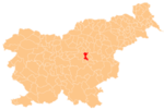
Čeče (pronounced [ˈtʃeːtʃɛ]) is a settlement in central Slovenia. It lies in the hills northeast of the town of Trbovlje. Administratively it is divided between the municipalities of Trbovlje and Hrastnik. The area is part of the traditional region of Styria. It is now included in the Central Sava Statistical Region.[2]
Name
The name of the settlement was changed from Sveta Katarina (literally, 'Saint Catherine') to Čeče (literally, 'hayfields') in 1955. The name was changed on the basis of the 1948 Law on Names of Settlements and Designations of Squares, Streets, and Buildings as part of efforts by Slovenia's postwar communist government to remove religious elements from toponyms.[3][4][5]
Church
The local church is dedicated to Saint Catherine and belongs to the Parish of Trbovlje. It dates to the 17th century.[6]
References
- ^ Statistical Office of the Republic of Slovenia
- ^ Trbovlje municipal site
- ^ Spremembe naselij 1948–95. 1996. Database. Ljubljana: Geografski inštitut ZRC SAZU, DZS.
- ^ Premk, F. 2004. Slovenska versko-krščanska terminologija v zemljepisnih imenih in spremembe za čas 1921–1967/68. Besedoslovne lastnosti slovenskega jezika: slovenska zemljepisna imena. Ljubljana: Slavistično društvo Slovenije, pp. 113–132.
- ^ Urbanc, Mimi, & Matej Gabrovec. 2005. Krajevna imena: poligon za dokazovanje moči in odraz lokalne identitete. Geografski vestnik 77(2): 25–43.
- ^ Slovenian Ministry of Culture register of national heritage reference number ešd 3456
External links
 Media related to Čeče at Wikimedia Commons
- Čeče on Geopedia
- v
- t
- e
Municipality of Trbovlje
Administrative seat: Trbovlje
| Current |
|
|---|---|
| Former |
- Mount Kum
- Trbovlje Chimney
- Trbovlje Museum
- Trbovlje–St. Martin's Parish Church
| ||||||
|---|---|---|---|---|---|---|
| Settlements | Administrative seat: Hrastnik
|  | ||||
| Landmarks |
| |||||
| Notable people |
| |||||


